Urriés geodata
Urriés (Aragon) is a seat of a third-order administrative division; located in Spain in Europe/Madrid (GMT+2) time zone. With population of 56 people, there are 6395 cities with bigger population in this country. Compared to other cities in Spain, 87.7% of cities are located further ↓South; 76.1% of cities are located further ←West and 58.5% of cities have higher elevation than Urriés. Note1


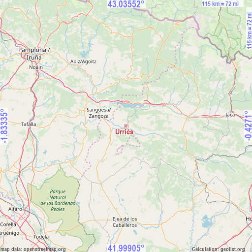
Urriés GPS coordinates[2]
42° 31' 9.948" North, 1° 7' 48.792" West
| Map corner | latitude | longitude |
|---|---|---|
| Upper-left | 43.03552°, | -1.83335° |
| Center: | 42.51943°, | -1.13022° |
| Lower-right: | 41.99905°, | -0.4271° |
| Map W x H: | 115.2×115.2 km | = 71.6×71.6mi |
| max Lat: | 43.74134° ⇑12.3% North |
| Urriés: | 42.51943° |
| min Lat: | ⇓87.7% South 27.64134° |
| min Long | Urriés | max Long |
| -18.00367° | -1.13022° | 4.2899° |
| W 76.1%⇐ | ⇒23.9% E |
Elevation
Elevation of Urriés is 548 m = 1798 ft, and this is 50 m = 164 ft below average elevation for this country.
| Max E: |
1682 m = 5518 ft | 58.5% |
| Avg. | 598 m = 1962 ft | |
| Urriés | 548 m = 1798 ft | |
Min E: |
0 m = 0 ft | 41.5% |
See also: Spain elevation on elevation.city.
Geographical zone
Urriés is located in North temperate zone (between Tropic of Cancer and the Arctic Circle). Distance of this Northern Tropic circle is 2121.8 km =1318.4 mi to South.| Distance of | km | miles | from Urriés |
|---|---|---|---|
| North Pole | 5279.3 | 3280.4 | to North |
| Arctic Circle | 2673.5 | 1661.2 | to North |
| Tropic Cancer | 2121.8 | 1318.4 | to South |
| Equator | 4727.7 | 2937.7 | to South |


Nearby cities:
15 places around Urriés: (largest is in red/bold)
• Artieda
14 km =8.7 mi,  58°
58°
• Bagüés
15.5 km =9.6 mi,  77°
77°
• Isuerre
7.2 km =4.5 mi,  119°
119°
• Javier
10.3 km =6.4 mi,  321°
321°
• Liédena
16.3 km =10.1 mi,  313°
313°
• Lobera de Onsella
10 km =6.2 mi, 117°
• Longás
16.6 km =10.3 mi,  104°
104°
• Mianos
16.1 km =10 mi, 62°
• Navardún
1.7 km =1.1 mi,  242°
242°
• Petilla de Aragón
7.8 km =4.8 mi,  171°
171°
• Sangüesa/Zangoza
13.9 km =8.6 mi,  296°
296°
• Sigüés
15.7 km =9.8 mi,  38°
38°
• Sos del Rey Católico
7.4 km =4.6 mi,  250°
250°
• Undués de Lerda
6.1 km =3.8 mi,  328°
328°
• Yesa
12.7 km =7.9 mi, 331°
Sources, notices
• [Note1] Compared only with cities in Spain existing in our database
• [Src1] Map data: © OpenStreetMap contributors (CC-BY-SA)
• [Src2] Other city data from geonames.org with taken over terms of usage.
• [Src3] Geographical zone / Annual Mean Temperature by Robert A. Rohde @ Wikipedia
