Sos del Rey Católico geodata
Sos del Rey Católico (Aragon) is a seat of a third-order administrative division; located in Spain in Europe/Madrid (GMT+2) time zone. With population of 737 people, there are 3332 cities with bigger population in this country. Compared to other cities in Spain, 87.1% of cities are located further ↓South; 75.5% of cities are located further ←West and 52.2% of cities have higher elevation than Sos del Rey Católico. Note1
Administrative division(s):
- Level 1: Aragon
- Level 2: Provincia de Zaragoza
- Level 3: Sos del Rey Católico


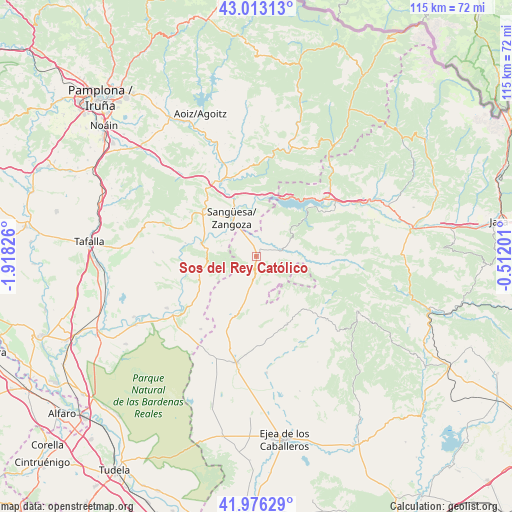
Sos del Rey Católico GPS coordinates[2]
42° 29' 48.696" North, 1° 12' 54.504" West
| Map corner | latitude | longitude |
|---|---|---|
| Upper-left | 43.01313°, | -1.91826° |
| Center: | 42.49686°, | -1.21514° |
| Lower-right: | 41.97629°, | -0.51201° |
| Map W x H: | 115.3×115.3 km | = 71.6×71.6mi |
| max Lat: | 43.74134° ⇑12.9% North |
| Sos del Rey Católico: | 42.49686° |
| min Lat: | ⇓87.1% South 27.64134° |
| min Long | Sos del Rey Cat | max Long |
| -18.00367° | -1.21514° | 4.2899° |
| W 75.5%⇐ | ⇒24.5% E |
Elevation
Elevation of Sos del Rey Católico is 634 m = 2080 ft, and this is 36 m = 118 ft above average elevation for this country.
| Max E: |
1682 m = 5518 ft | 52.2% |
| Sos del Rey Católico | 634 m 2080 ft | |
| Avg. | 598 m = 1962 ft | |
Min E: |
0 m = 0 ft | 47.8% |
See also: Spain elevation on elevation.city.
Geographical zone
Sos del Rey Católico is located in North temperate zone (between Tropic of Cancer and the Arctic Circle). Distance of this Northern Tropic circle is 2119.3 km =1316.9 mi to South.| Distance of | km | miles | from Sos del Rey Católico |
|---|---|---|---|
| North Pole | 5281.9 | 3282 | to North |
| Arctic Circle | 2676 | 1662.8 | to North |
| Tropic Cancer | 2119.3 | 1316.9 | to South |
| Equator | 4725.2 | 2936.1 | to South |


Nearby cities:
15 places around Sos del Rey Católico: (largest is in red/bold)
• Castiliscar
14.2 km =8.8 mi,  199°
199°
• Cáseda
12.7 km =7.9 mi,  282°
282°
• Gallipienzo
16.4 km =10.2 mi, 280°
• Isuerre
13.3 km =8.3 mi,  94°
94°
• Javier
10.5 km =6.5 mi,  2°
2°
• Liédena
14.5 km =9 mi,  339°
339°
• Lobera de Onsella
16 km =9.9 mi,  97°
97°
• Navardún
5.8 km =3.6 mi,  72°
72°
• Petilla de Aragón
9.6 km =6 mi,  122°
122°
• Sangüesa/Zangoza
10.3 km =6.4 mi,  327°
327°
• Uncastillo
16.8 km =10.4 mi,  154°
154°
• Undués de Lerda
8.5 km =5.3 mi,  26°
26°
• Urriés
7.4 km =4.6 mi, 70°
• Yesa
13.8 km =8.6 mi, 3°
• Áibar
15.9 km =9.9 mi,  311°
311°
Sources, notices
• [Note1] Compared only with cities in Spain existing in our database
• [Src1] Map data: © OpenStreetMap contributors (CC-BY-SA)
• [Src2] Other city data from geonames.org with taken over terms of usage.
• [Src3] Geographical zone / Annual Mean Temperature by Robert A. Rohde @ Wikipedia
