Sangüesa/Zangoza geodata
Sangüesa/Zangoza (Navarre) is a populated place; located in Spain in Europe/Madrid (GMT+2) time zone. With population of 5,030 people, there are 1297 cities with bigger population in this country. Compared to other cities in Spain, 88.8% of cities are located further ↓South; 74.9% of cities are located further ←West and 68.6% of cities have higher elevation than Sangüesa/Zangoza. Note1


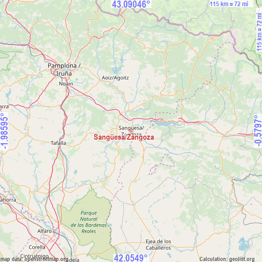
Sangüesa/Zangoza GPS coordinates[2]
42° 34' 29.388" North, 1° 16' 58.188" West
| Map corner | latitude | longitude |
|---|---|---|
| Upper-left | 43.09046°, | -1.98595° |
| Center: | 42.57483°, | -1.28283° |
| Lower-right: | 42.0549°, | -0.5797° |
| Map W x H: | 115.1×115.1 km | = 71.5×71.5mi |
| max Lat: | 43.74134° ⇑11.2% North |
| Sangüesa/Zangoza: | 42.57483° |
| min Lat: | ⇓88.8% South 27.64134° |
| min Long | Sangüesa/Zango | max Long |
| -18.00367° | -1.28283° | 4.2899° |
| W 74.9%⇐ | ⇒25.1% E |
Elevation
Elevation of Sangüesa/Zangoza is 405 m = 1329 ft, and this is 193 m = 633 ft below average elevation for this country.
| Max E: |
1682 m = 5518 ft | 68.6% |
| Avg. | 598 m = 1962 ft | |
| Sangüesa/Zangoza | 405 m = 1329 ft | |
Min E: |
0 m = 0 ft | 31.4% |
See also: Spain elevation on elevation.city.
Geographical zone
Sangüesa/Zangoza is located in North temperate zone (between Tropic of Cancer and the Arctic Circle). Distance of this Northern Tropic circle is 2128 km =1322.3 mi to South.| Distance of | km | miles | from Sangüesa/Zangoza |
|---|---|---|---|
| North Pole | 5273.2 | 3276.6 | to North |
| Arctic Circle | 2667.3 | 1657.4 | to North |
| Tropic Cancer | 2128 | 1322.3 | to South |
| Equator | 4733.9 | 2941.5 | to South |


Nearby cities:
15 places around Sangüesa/Zangoza: (largest is in red/bold)
• Cáseda
9 km =5.6 mi,  229°
229°
• Eslava
14.5 km =9 mi,  265°
265°
• Gallipienzo
11.9 km =7.4 mi,  241°
241°
• Javier
6.3 km =3.9 mi,  73°
73°
• Leache
10.8 km =6.7 mi,  289°
289°
• Lerga
17.9 km =11.1 mi, 267°
• Liédena
5 km =3.1 mi,  6°
6°
• Lumbier
8.9 km =5.5 mi,  347°
347°
• Navardún
13 km =8.1 mi,  122°
122°
• Petilla de Aragón
19.4 km =12.1 mi,  135°
135°
• Sos del Rey Católico
10.3 km =6.4 mi,  147°
147°
• Undués de Lerda
9.3 km =5.8 mi,  96°
96°
• Urriés
13.9 km =8.6 mi, 116°
• Yesa
8.2 km =5.1 mi,  52°
52°
• Áibar
6.6 km =4.1 mi, 286°
In other languages:
- In Spanish: Sangüesa
- In France: Sangüesa
- In Italian: Sangüesa
- In Russian: Сангуэса
- In Chinese: 桑格萨
Sources, notices
• [Note1] Compared only with cities in Spain existing in our database
• [Src1] Map data: © OpenStreetMap contributors (CC-BY-SA)
• [Src2] Other city data from geonames.org with taken over terms of usage.
• [Src3] Geographical zone / Annual Mean Temperature by Robert A. Rohde @ Wikipedia
