Súria geodata
Súria (Catalonia) is a populated place; located in Spain in Europe/Madrid (GMT+2) time zone. With population of 6,230 people, there are 1109 cities with bigger population in this country. Compared to other cities in Spain, 69.4% of cities are located further ↓South; 92.4% of cities are located further ←West and 76.3% of cities have higher elevation than Súria. Note1
Administrative division(s):
- Level 1: Catalonia
- Level 2: Província de Barcelona
- Level 3: Sant Mateu de Bages


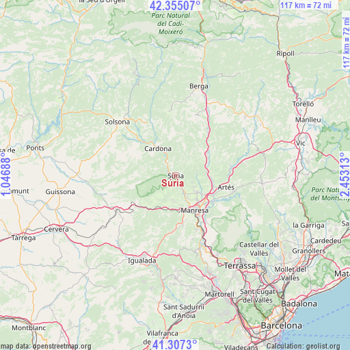
Súria GPS coordinates[2]
41° 49' 59.988" North, 1° 45' 0" East
| Map corner | latitude | longitude |
|---|---|---|
| Upper-left | 42.35507°, | 1.04688° |
| Center: | 41.83333°, | 1.75° |
| Lower-right: | 41.3073°, | 2.45313° |
| Map W x H: | 116.5×116.5 km | = 72.4×72.4mi |
| max Lat: | 43.74134° ⇑30.6% North |
| Súria: | 41.83333° |
| min Lat: | ⇓69.4% South 27.64134° |
| min Long | Súria | max Long |
| -18.00367° | 1.75° | 4.2899° |
| W 92.4%⇐ | ⇒7.6% E |
Elevation
Elevation of Súria is 281 m = 922 ft, and this is 317 m = 1040 ft below average elevation for this country.
| Max E: |
1682 m = 5518 ft | 76.3% |
| Avg. | 598 m = 1962 ft | |
| Súria | 281 m = 922 ft | |
Min E: |
0 m = 0 ft | 23.7% |
See also: Spain elevation on elevation.city.
Geographical zone
Súria is located in North temperate zone (between Tropic of Cancer and the Arctic Circle). Distance of this Northern Tropic circle is 2045.5 km =1271 mi to South.| Distance of | km | miles | from Súria |
|---|---|---|---|
| North Pole | 5355.6 | 3327.8 | to North |
| Arctic Circle | 2749.7 | 1708.6 | to North |
| Tropic Cancer | 2045.5 | 1271 | to South |
| Equator | 4651.4 | 2890.2 | to South |


Nearby cities:
15 places around Súria: (largest is in red/bold)
• Aguilar de Segarra
13.8 km =8.6 mi,  226°
226°
• Balsareny
10.8 km =6.7 mi,  72°
72°
• Callús
6.4 km =4 mi,  153°
153°
• Cardona
10.7 km =6.6 mi,  326°
326°
• Castellnou de Bages
7.2 km =4.5 mi,  89°
89°
• Fonollosa
10.3 km =6.4 mi,  220°
220°
• Manresa
13.2 km =8.2 mi, 152°
• Navarcles
15.6 km =9.7 mi,  125°
125°
• Navàs
12.9 km =8 mi,  54°
54°
• Rajadell
12.3 km =7.6 mi,  197°
197°
• Sallent
12.1 km =7.5 mi, 93°
• Sant Fruitós de Bages
13.4 km =8.3 mi, 133°
• Sant Joan de Vilatorrada
10.8 km =6.7 mi,  155°
155°
• Sant Salvador de Guardiola
16.7 km =10.4 mi,  175°
175°
• Santpedor
9.8 km =6.1 mi,  124°
124°
Sources, notices
• [Note1] Compared only with cities in Spain existing in our database
• [Src1] Map data: © OpenStreetMap contributors (CC-BY-SA)
• [Src2] Other city data from geonames.org with taken over terms of usage.
• [Src3] Geographical zone / Annual Mean Temperature by Robert A. Rohde @ Wikipedia
