Sotillo de la Adrada geodata
Sotillo de la Adrada (Castille and León) is a seat of a third-order administrative division; located in Spain in Europe/Madrid (GMT+2) time zone. With population of 4,188 people, there are 1437 cities with bigger population in this country. Compared to other cities in Spain, 66% of cities are located further ↑North; 67.2% of cities are located further →East and 52.2% of cities have higher elevation than Sotillo de la Adrada. Note1
Administrative division(s):
- Level 1: Castille and León
- Level 2: Provincia de Ávila
- Level 3: Sotillo de la Adrada


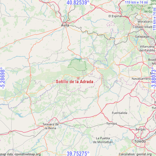
Sotillo de la Adrada GPS coordinates[2]
40° 17' 28.32" North, 4° 35' 1.86" West
| Map corner | latitude | longitude |
|---|---|---|
| Upper-left | 40.82539°, | -5.28698° |
| Center: | 40.2912°, | -4.58385° |
| Lower-right: | 39.75275°, | -3.88073° |
| Map W x H: | 119.3×119.3 km | = 74.1×74.1mi |
| max Lat: | 43.74134° ⇑66% North |
| Sotillo de la Adrada: | 40.2912° |
| min Lat: | ⇓34% South 27.64134° |
| min Long | Sotillo de la A | max Long |
| -18.00367° | -4.58385° | 4.2899° |
| W 32.8%⇐ | ⇒67.2% E |
Elevation
Elevation of Sotillo de la Adrada is 634 m = 2080 ft, and this is 36 m = 118 ft above average elevation for this country.
| Max E: |
1682 m = 5518 ft | 52.2% |
| Sotillo de la Adrada | 634 m 2080 ft | |
| Avg. | 598 m = 1962 ft | |
Min E: |
0 m = 0 ft | 47.8% |
See also: Spain elevation on elevation.city.
Geographical zone
Sotillo de la Adrada is located in North temperate zone (between Tropic of Cancer and the Arctic Circle). Distance of this Northern Tropic circle is 1874 km =1164.4 mi to South.| Distance of | km | miles | from Sotillo de la Adrada |
|---|---|---|---|
| North Pole | 5527.1 | 3434.4 | to North |
| Arctic Circle | 2921.2 | 1815.1 | to North |
| Tropic Cancer | 1874 | 1164.4 | to South |
| Equator | 4480 | 2783.7 | to South |


Nearby cities:
15 places around Sotillo de la Adrada: (largest is in red/bold)
• Cadalso de los Vidrios
12.8 km =8 mi,  85°
85°
• Casavieja
15.5 km =9.6 mi,  266°
266°
• Casillas
4 km =2.5 mi,  14°
14°
• Cenicientos
10.4 km =6.5 mi,  106°
106°
• El Tiemblo
15.5 km =9.6 mi,  26°
26°
• Fresnedilla
7.3 km =4.5 mi,  206°
206°
• Higuera de las Dueñas
6 km =3.7 mi,  196°
196°
• La Adrada
4.5 km =2.8 mi,  281°
281°
• Navahondilla
8.3 km =5.2 mi,  62°
62°
• Navaluenga
17 km =10.6 mi,  321°
321°
• Nombela
16.6 km =10.3 mi,  155°
155°
• Paredes de Escalona
16.2 km =10.1 mi,  126°
126°
• Pelahustán
12.9 km =8 mi,  185°
185°
• Piedralaves
10.3 km =6.4 mi,  286°
286°
• Rozas de Puerto Real
9 km =5.6 mi,  71°
71°
Sources, notices
• [Note1] Compared only with cities in Spain existing in our database
• [Src1] Map data: © OpenStreetMap contributors (CC-BY-SA)
• [Src2] Other city data from geonames.org with taken over terms of usage.
• [Src3] Geographical zone / Annual Mean Temperature by Robert A. Rohde @ Wikipedia
