Pelahustán geodata
Pelahustán (Castille-La Mancha) is a seat of a third-order administrative division; located in Spain in Europe/Madrid (GMT+2) time zone. With population of 364 people, there are 4265 cities with bigger population in this country. Compared to other cities in Spain, 67.6% of cities are located further ↑North; 67.3% of cities are located further →East and 51.6% of cities have lower elevation than Pelahustán. Note1
Administrative division(s):
- Level 1: Castille-La Mancha
- Level 2: Province of Toledo
- Level 3: Pelahustán


Pelahustán GPS coordinates[2]
40° 10' 33.564" North, 4° 35' 54.312" West
| Map corner | latitude | longitude |
|---|---|---|
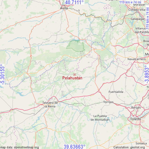
| Upper-left | 40.7111°, | -5.30155° |
| Center: | 40.17599°, | -4.59842° |
| Lower-right: | 39.63663°, | -3.8953° |
| Map W x H: | 119.5×119.5 km | = 74.3×74.3mi |
| max Lat: | 43.74134° ⇑67.6% North |
| Pelahustán: | 40.17599° |
| min Lat: | ⇓32.4% South 27.64134° |
| min Long | Pelahustán | max Long |
| -18.00367° | -4.59842° | 4.2899° |
| W 32.7%⇐ | ⇒67.3% E |
Elevation
Elevation of Pelahustán is 676 m = 2218 ft, and this is 78 m = 256 ft above average elevation for this country.
| Max E: |
1682 m = 5518 ft | 48.4% |
| Pelahustán | 676 m 2218 ft | |
| Avg. | 598 m = 1962 ft | |
Min E: |
0 m = 0 ft | 51.6% |
See also: Spain elevation on elevation.city.
Geographical zone
Pelahustán is located in North temperate zone (between Tropic of Cancer and the Arctic Circle). Distance of this Northern Tropic circle is 1861.2 km =1156.5 mi to South.| Distance of | km | miles | from Pelahustán |
|---|---|---|---|
| North Pole | 5539.9 | 3442.3 | to North |
| Arctic Circle | 2934 | 1823.1 | to North |
| Tropic Cancer | 1861.2 | 1156.5 | to South |
| Equator | 4467.2 | 2775.8 | to South |


Nearby cities:
15 places around Pelahustán: (largest is in red/bold)
• Almendral de la Cañada
12.2 km =7.6 mi,  274°
274°
• Cardiel de los Montes
13.4 km =8.3 mi,  200°
200°
• Castillo de Bayuela
11.2 km =7 mi,  221°
221°
• Cenicientos
14.9 km =9.3 mi,  48°
48°
• El Casar de Escalona
15.7 km =9.8 mi,  156°
156°
• El Real de San Vicente
9.1 km =5.7 mi,  240°
240°
• Fresnedilla
6.6 km =4.1 mi,  342°
342°
• Higuera de las Dueñas
7 km =4.3 mi,  356°
356°
• Hinojosa de San Vicente
13.2 km =8.2 mi,  233°
233°
• Hormigos
15.7 km =9.8 mi,  123°
123°
• La Adrada
14.1 km =8.8 mi,  346°
346°
• Nombela
8.5 km =5.3 mi,  105°
105°
• Nuño Gómez
7.1 km =4.4 mi,  194°
194°
• Paredes de Escalona
14.6 km =9.1 mi,  77°
77°
• Sotillo de la Adrada
12.9 km =8 mi,  5°
5°
Sources, notices
• [Note1] Compared only with cities in Spain existing in our database
• [Src1] Map data: © OpenStreetMap contributors (CC-BY-SA)
• [Src2] Other city data from geonames.org with taken over terms of usage.
• [Src3] Geographical zone / Annual Mean Temperature by Robert A. Rohde @ Wikipedia
