Fresnedilla geodata
Fresnedilla (Castille and León) is a seat of a third-order administrative division; located in Spain in Europe/Madrid (GMT+2) time zone. With population of 99 people, there are 5951 cities with bigger population in this country. Compared to other cities in Spain, 66.7% of cities are located further ↑North; 67.6% of cities are located further →East and 53.4% of cities have higher elevation than Fresnedilla. Note1
Administrative division(s):
- Level 1: Castille and León
- Level 2: Provincia de Ávila
- Level 3: Fresnedilla


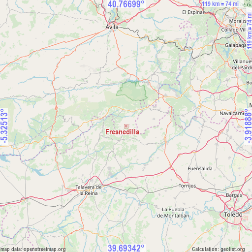
Fresnedilla GPS coordinates[2]
40° 13' 56.388" North, 4° 37' 19.236" West
| Map corner | latitude | longitude |
|---|---|---|
| Upper-left | 40.76699°, | -5.32513° |
| Center: | 40.23233°, | -4.62201° |
| Lower-right: | 39.69342°, | -3.91888° |
| Map W x H: | 119.4×119.4 km | = 74.2×74.2mi |
| max Lat: | 43.74134° ⇑66.7% North |
| Fresnedilla: | 40.23233° |
| min Lat: | ⇓33.3% South 27.64134° |
| min Long | Fresnedilla | max Long |
| -18.00367° | -4.62201° | 4.2899° |
| W 32.4%⇐ | ⇒67.6% E |
Elevation
Elevation of Fresnedilla is 619 m = 2031 ft, and this is 21 m = 69 ft above average elevation for this country.
| Max E: |
1682 m = 5518 ft | 53.4% |
| Fresnedilla | 619 m 2031 ft | |
| Avg. | 598 m = 1962 ft | |
Min E: |
0 m = 0 ft | 46.6% |
See also: Spain elevation on elevation.city.
Geographical zone
Fresnedilla is located in North temperate zone (between Tropic of Cancer and the Arctic Circle). Distance of this Northern Tropic circle is 1867.5 km =1160.4 mi to South.| Distance of | km | miles | from Fresnedilla |
|---|---|---|---|
| North Pole | 5533.6 | 3438.4 | to North |
| Arctic Circle | 2927.8 | 1819.3 | to North |
| Tropic Cancer | 1867.5 | 1160.4 | to South |
| Equator | 4473.4 | 2779.6 | to South |


Nearby cities:
15 places around Fresnedilla: (largest is in red/bold)
• Almendral de la Cañada
11.5 km =7.1 mi,  242°
242°
• Casavieja
13.5 km =8.4 mi,  294°
294°
• Casillas
11.3 km =7 mi,  22°
22°
• Cenicientos
13.6 km =8.5 mi,  74°
74°
• El Real de San Vicente
12.2 km =7.6 mi,  208°
208°
• Higuera de las Dueñas
1.7 km =1.1 mi,  64°
64°
• La Adrada
7.6 km =4.7 mi,  351°
351°
• Navahondilla
14.8 km =9.2 mi,  45°
45°
• Nombela
13.3 km =8.3 mi,  130°
130°
• Nuño Gómez
13.2 km =8.2 mi,  179°
179°
• Pelahustán
6.6 km =4.1 mi,  162°
162°
• Piedralaves
11.5 km =7.1 mi,  324°
324°
• Rozas de Puerto Real
15 km =9.3 mi, 51°
• Sartajada
14.8 km =9.2 mi,  261°
261°
• Sotillo de la Adrada
7.3 km =4.5 mi,  26°
26°
Sources, notices
• [Note1] Compared only with cities in Spain existing in our database
• [Src1] Map data: © OpenStreetMap contributors (CC-BY-SA)
• [Src2] Other city data from geonames.org with taken over terms of usage.
• [Src3] Geographical zone / Annual Mean Temperature by Robert A. Rohde @ Wikipedia
