Sorlada geodata
Sorlada (Navarre) is a seat of a third-order administrative division; located in Spain in Europe/Madrid (GMT+2) time zone. With population of 38 people, there are 6589 cities with bigger population in this country. Compared to other cities in Spain, 89.8% of cities are located further ↓South; 64.5% of cities are located further ←West and 56.6% of cities have higher elevation than Sorlada. Note1


Sorlada GPS coordinates[2]
42° 36' 54.252" North, 2° 12' 54.9" West
| Map corner | latitude | longitude |
|---|---|---|
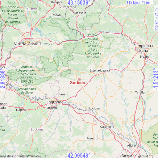
| Upper-left | 43.13036°, | -2.91838° |
| Center: | 42.61507°, | -2.21525° |
| Lower-right: | 42.09548°, | -1.51213° |
| Map W x H: | 115.1×115.1 km | = 71.5×71.5mi |
| max Lat: | 43.74134° ⇑10.2% North |
| Sorlada: | 42.61507° |
| min Lat: | ⇓89.8% South 27.64134° |
| min Long | Sorlada | max Long |
| -18.00367° | -2.21525° | 4.2899° |
| W 64.5%⇐ | ⇒35.5% E |
Elevation
Elevation of Sorlada is 572 m = 1877 ft, and this is 26 m = 85 ft below average elevation for this country.
| Max E: |
1682 m = 5518 ft | 56.6% |
| Avg. | 598 m = 1962 ft | |
| Sorlada | 572 m = 1877 ft | |
Min E: |
0 m = 0 ft | 43.4% |
See also: Spain elevation on elevation.city.
Geographical zone
Sorlada is located in North temperate zone (between Tropic of Cancer and the Arctic Circle). Distance of this Northern Tropic circle is 2132.4 km =1325 mi to South.| Distance of | km | miles | from Sorlada |
|---|---|---|---|
| North Pole | 5268.7 | 3273.8 | to North |
| Arctic Circle | 2662.8 | 1654.6 | to North |
| Tropic Cancer | 2132.4 | 1325 | to South |
| Equator | 4738.4 | 2944.3 | to South |


Nearby cities:
15 places around Sorlada: (largest is in red/bold)
• Abáigar
7 km =4.3 mi,  58°
58°
• Ancín
5.5 km =3.4 mi,  23°
23°
• Armañanzas
8.4 km =5.2 mi,  222°
222°
• Desojo
5.7 km =3.5 mi,  238°
238°
• Espronceda
7.6 km =4.7 mi,  254°
254°
• Etayo
5 km =3.1 mi,  87°
87°
• Legaria
5.1 km =3.2 mi,  41°
41°
• Los Arcos
5.3 km =3.3 mi,  159°
159°
• Mirafuentes
5.3 km =3.3 mi,  279°
279°
• Murieta
6.8 km =4.2 mi,  47°
47°
• Nazar
5.8 km =3.6 mi,  294°
294°
• Oco
4.9 km =3 mi, 58°
• Olejua
6.1 km =3.8 mi,  81°
81°
• Piedramillera
2.1 km =1.3 mi,  25°
25°
• Sansol
8 km =5 mi,  211°
211°
Sources, notices
• [Note1] Compared only with cities in Spain existing in our database
• [Src1] Map data: © OpenStreetMap contributors (CC-BY-SA)
• [Src2] Other city data from geonames.org with taken over terms of usage.
• [Src3] Geographical zone / Annual Mean Temperature by Robert A. Rohde @ Wikipedia
