Sarracín geodata
Sarracín (Castille and León) is a seat of a third-order administrative division; located in Spain in Europe/Madrid (GMT+2) time zone. With population of 303 people, there are 4490 cities with bigger population in this country. Compared to other cities in Spain, 80.8% of cities are located further ↓South; 55.1% of cities are located further →East and 76.1% of cities have lower elevation than Sarracín. Note1
Administrative division(s):
- Level 1: Castille and León
- Level 2: Provincia de Burgos
- Level 3: Sarracín


Sarracín GPS coordinates[2]
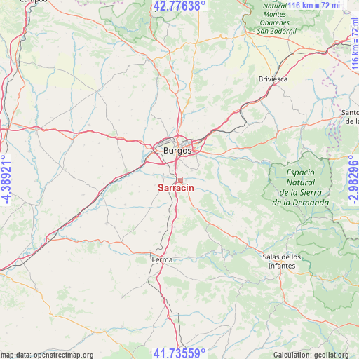
42° 15' 29.268" North, 3° 41' 9.888" West
| Map corner | latitude | longitude |
|---|---|---|
| Upper-left | 42.77638°, | -4.38921° |
| Center: | 42.25813°, | -3.68608° |
| Lower-right: | 41.73559°, | -2.98296° |
| Map W x H: | 115.7×115.7 km | = 71.9×71.9mi |
| max Lat: | 43.74134° ⇑19.2% North |
| Sarracín: | 42.25813° |
| min Lat: | ⇓80.8% South 27.64134° |
| min Long | Sarracín | max Long |
| -18.00367° | -3.68608° | 4.2899° |
| W 44.9%⇐ | ⇒55.1% E |
Elevation
Elevation of Sarracín is 861 m = 2825 ft, and this is 263 m = 863 ft above average elevation for this country.
| Max E: |
1682 m = 5518 ft | 23.9% |
| Sarracín | 861 m 2825 ft | |
| Avg. | 598 m = 1962 ft | |
Min E: |
0 m = 0 ft | 76.1% |
See also: Spain elevation on elevation.city.
Geographical zone
Sarracín is located in North temperate zone (between Tropic of Cancer and the Arctic Circle). Distance of this Northern Tropic circle is 2092.7 km =1300.3 mi to South.| Distance of | km | miles | from Sarracín |
|---|---|---|---|
| North Pole | 5308.4 | 3298.5 | to North |
| Arctic Circle | 2702.5 | 1679.3 | to North |
| Tropic Cancer | 2092.7 | 1300.3 | to South |
| Equator | 4698.7 | 2919.6 | to South |


Nearby cities:
15 places around Sarracín: (largest is in red/bold)
• Albillos
8.7 km =5.4 mi,  283°
283°
• Arcos
5.7 km =3.5 mi, 279°
• Burgos
9.3 km =5.8 mi,  351°
351°
• Carcedo de Burgos
6.1 km =3.8 mi,  58°
58°
• Cardeñadijo
5.1 km =3.2 mi,  17°
17°
• Cardeñajimeno
9.7 km =6 mi,  33°
33°
• Castrillo del Val
10.4 km =6.5 mi,  53°
53°
• Cogollos
6.6 km =4.1 mi,  190°
190°
• Hontoria de la Cantera
8.5 km =5.3 mi,  155°
155°
• Modúbar de la Emparedada
2.2 km =1.4 mi,  81°
81°
• Revillarruz
4.2 km =2.6 mi,  138°
138°
• Saldaña de Burgos
0.9 km =0.6 mi,  271°
271°
• Valdorros
9.7 km =6 mi, 191°
• Villagonzalo-Pedernales
6.3 km =3.9 mi,  319°
319°
• Villariezo
4 km =2.5 mi,  288°
288°
Sources, notices
• [Note1] Compared only with cities in Spain existing in our database
• [Src1] Map data: © OpenStreetMap contributors (CC-BY-SA)
• [Src2] Other city data from geonames.org with taken over terms of usage.
• [Src3] Geographical zone / Annual Mean Temperature by Robert A. Rohde @ Wikipedia
