Modúbar de la Emparedada geodata
Modúbar de la Emparedada (Castille and León) is a seat of a third-order administrative division; located in Spain in Europe/Madrid (GMT+2) time zone. With population of 383 people, there are 4194 cities with bigger population in this country. Compared to other cities in Spain, 80.9% of cities are located further ↓South; 54.7% of cities are located further →East and 78.5% of cities have lower elevation than Modúbar de la Emparedada. Note1
Administrative division(s):
- Level 1: Castille and León
- Level 2: Provincia de Burgos
- Level 3: Modúbar de la Emparedada
Current local time in Modúbar de la Emparedada:
10:58 PM, ThursdayDifference from your time zone: hours


Modúbar de la Emparedada GPS coordinates[2]
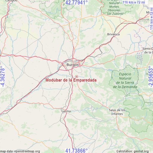
42° 15' 40.248" North, 3° 39' 34.74" West
| Map corner | latitude | longitude |
|---|---|---|
| Upper-left | 42.77941°, | -4.36278° |
| Center: | 42.26118°, | -3.65965° |
| Lower-right: | 41.73866°, | -2.95653° |
| Map W x H: | 115.7×115.7 km | = 71.9×71.9mi |
| max Lat: | 43.74134° ⇑19.1% North |
| Modúbar de la Emparedada: | 42.26118° |
| min Lat: | ⇓80.9% South 27.64134° |
| min Long | Modúbar de la | max Long |
| -18.00367° | -3.65965° | 4.2899° |
| W 45.3%⇐ | ⇒54.7% E |
Elevation
Elevation of Modúbar de la Emparedada is 885 m = 2904 ft, and this is 287 m = 942 ft above average elevation for this country.
| Max E: |
1682 m = 5518 ft | 21.5% |
| Modúbar de la Emparedada | 885 m 2904 ft | |
| Avg. | 598 m = 1962 ft | |
Min E: |
0 m = 0 ft | 78.5% |
See also: Spain elevation on elevation.city.
Geographical zone
Modúbar de la Emparedada is located in North temperate zone (between Tropic of Cancer and the Arctic Circle). Distance of this Northern Tropic circle is 2093.1 km =1300.6 mi to South.| Distance of | km | miles | from Modúbar de la Emparedada |
|---|---|---|---|
| North Pole | 5308.1 | 3298.3 | to North |
| Arctic Circle | 2702.2 | 1679.1 | to North |
| Tropic Cancer | 2093.1 | 1300.6 | to South |
| Equator | 4699 | 2919.8 | to South |


Nearby cities:
15 places around Modúbar de la Emparedada: (largest is in red/bold)
• Arcos
7.8 km =4.8 mi,  274°
274°
• Burgos
9.5 km =5.9 mi,  338°
338°
• Carcedo de Burgos
4.2 km =2.6 mi,  46°
46°
• Cardeñadijo
4.6 km =2.9 mi,  351°
351°
• Cardeñajimeno
8.3 km =5.2 mi,  22°
22°
• Castrillo del Val
8.5 km =5.3 mi, 46°
• Cogollos
7.6 km =4.7 mi,  205°
205°
• Gamonal
10.7 km =6.6 mi, 354°
• Hontoria de la Cantera
8.2 km =5.1 mi,  170°
170°
• Revillarruz
3.5 km =2.2 mi, 170°
• Saldaña de Burgos
3.1 km =1.9 mi,  264°
264°
• Sarracín
2.2 km =1.4 mi, 261°
• Valdorros
10.7 km =6.6 mi,  202°
202°
• Villagonzalo-Pedernales
7.7 km =4.8 mi,  305°
305°
• Villariezo
6.1 km =3.8 mi,  278°
278°
Sources, notices
• [Note1] Compared only with cities in Spain existing in our database
• [Src1] Map data: © OpenStreetMap contributors (CC-BY-SA)
• [Src2] Other city data from geonames.org with taken over terms of usage.
• [Src3] Geographical zone / Annual Mean Temperature by Robert A. Rohde @ Wikipedia
