Cardeñajimeno geodata
Cardeñajimeno (Castille and León) is a seat of a third-order administrative division; located in Spain in Europe/Madrid (GMT+2) time zone. With population of 650 people, there are 3500 cities with bigger population in this country. Compared to other cities in Spain, 82.7% of cities are located further ↓South; 54.1% of cities are located further →East and 82.8% of cities have lower elevation than Cardeñajimeno. Note1
Administrative division(s):
- Level 1: Castille and León
- Level 2: Provincia de Burgos
- Level 3: Cardeñajimeno


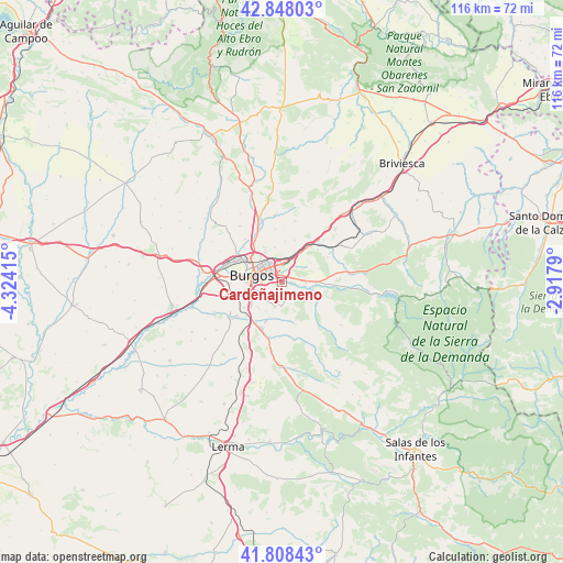
Cardeñajimeno GPS coordinates[2]
42° 19' 49.368" North, 3° 37' 15.708" West
| Map corner | latitude | longitude |
|---|---|---|
| Upper-left | 42.84803°, | -4.32415° |
| Center: | 42.33038°, | -3.62103° |
| Lower-right: | 41.80843°, | -2.9179° |
| Map W x H: | 115.6×115.6 km | = 71.8×71.8mi |
| max Lat: | 43.74134° ⇑17.3% North |
| Cardeñajimeno: | 42.33038° |
| min Lat: | ⇓82.7% South 27.64134° |
| min Long | Cardeñajimeno | max Long |
| -18.00367° | -3.62103° | 4.2899° |
| W 45.9%⇐ | ⇒54.1% E |
Elevation
Elevation of Cardeñajimeno is 926 m = 3038 ft, and this is 328 m = 1076 ft above average elevation for this country.
| Max E: |
1682 m = 5518 ft | 17.2% |
| Cardeñajimeno | 926 m 3038 ft | |
| Avg. | 598 m = 1962 ft | |
Min E: |
0 m = 0 ft | 82.8% |
See also: Spain elevation on elevation.city.
Geographical zone
Cardeñajimeno is located in North temperate zone (between Tropic of Cancer and the Arctic Circle). Distance of this Northern Tropic circle is 2100.8 km =1305.4 mi to South.| Distance of | km | miles | from Cardeñajimeno |
|---|---|---|---|
| North Pole | 5300.4 | 3293.5 | to North |
| Arctic Circle | 2694.5 | 1674.3 | to North |
| Tropic Cancer | 2100.8 | 1305.4 | to South |
| Equator | 4706.7 | 2924.6 | to South |


Nearby cities:
15 places around Cardeñajimeno: (largest is in red/bold)
• Atapuerca
10.7 km =6.6 mi,  60°
60°
• Burgos
6.7 km =4.2 mi,  280°
280°
• Carcedo de Burgos
4.8 km =3 mi,  181°
181°
• Cardeñadijo
5 km =3.1 mi,  230°
230°
• Castrillo del Val
3.5 km =2.2 mi,  121°
121°
• Gamonal
5.2 km =3.2 mi,  304°
304°
• Hurones
8.4 km =5.2 mi,  2°
2°
• Ibeas de Juarros
7.1 km =4.4 mi,  89°
89°
• Modúbar de la Emparedada
8.3 km =5.2 mi,  202°
202°
• Quintanapalla
11.4 km =7.1 mi,  39°
39°
• Quintanilla-Vivar
11 km =6.8 mi,  329°
329°
• Rubena
7.4 km =4.6 mi,  30°
30°
• Saldaña de Burgos
10.2 km =6.3 mi,  217°
217°
• Sarracín
9.7 km =6 mi,  213°
213°
• Villagonzalo-Pedernales
9.9 km =6.2 mi,  251°
251°
Sources, notices
• [Note1] Compared only with cities in Spain existing in our database
• [Src1] Map data: © OpenStreetMap contributors (CC-BY-SA)
• [Src2] Other city data from geonames.org with taken over terms of usage.
• [Src3] Geographical zone / Annual Mean Temperature by Robert A. Rohde @ Wikipedia
