San Vicente del Valle geodata
San Vicente del Valle (Castille and León) is a seat of a third-order administrative division; located in Spain in Europe/Madrid (GMT+2) time zone. With population of 61 people, there are 6339 cities with bigger population in this country. Compared to other cities in Spain, 83% of cities are located further ↓South; 52.1% of cities are located further ←West and 85.6% of cities have lower elevation than San Vicente del Valle. Note1
Administrative division(s):
- Level 1: Castille and León
- Level 2: Provincia de Burgos
- Level 3: San Vicente del Valle
Current local time in San Vicente del Valle:
10:58 PM, ThursdayDifference from your time zone: hours


San Vicente del Valle GPS coordinates[2]
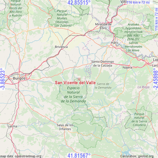
42° 20' 15.216" North, 3° 9' 43.56" West
| Map corner | latitude | longitude |
|---|---|---|
| Upper-left | 42.85515°, | -3.86523° |
| Center: | 42.33756°, | -3.1621° |
| Lower-right: | 41.81567°, | -2.45898° |
| Map W x H: | 115.6×115.6 km | = 71.8×71.8mi |
| max Lat: | 43.74134° ⇑17% North |
| San Vicente del Valle: | 42.33756° |
| min Lat: | ⇓83% South 27.64134° |
| min Long | San Vicente del | max Long |
| -18.00367° | -3.1621° | 4.2899° |
| W 52.1%⇐ | ⇒47.9% E |
Elevation
Elevation of San Vicente del Valle is 959 m = 3146 ft, and this is 361 m = 1184 ft above average elevation for this country.
| Max E: |
1682 m = 5518 ft | 14.4% |
| San Vicente del Valle | 959 m 3146 ft | |
| Avg. | 598 m = 1962 ft | |
Min E: |
0 m = 0 ft | 85.6% |
See also: Spain elevation on elevation.city.
Geographical zone
San Vicente del Valle is located in North temperate zone (between Tropic of Cancer and the Arctic Circle). Distance of this Northern Tropic circle is 2101.6 km =1305.9 mi to South.| Distance of | km | miles | from San Vicente del Valle |
|---|---|---|---|
| North Pole | 5299.6 | 3293 | to North |
| Arctic Circle | 2693.7 | 1673.8 | to North |
| Tropic Cancer | 2101.6 | 1305.9 | to South |
| Equator | 4707.5 | 2925.1 | to South |


Nearby cities:
15 places around San Vicente del Valle: (largest is in red/bold)
• Bascuñana
11.8 km =7.3 mi,  33°
33°
• Belorado
9.5 km =5.9 mi,  345°
345°
• Espinosa del Camino
12.3 km =7.6 mi,  308°
308°
• Ezcaray
12.3 km =7.6 mi,  96°
96°
• Fresneda de la Sierra Tirón
3.3 km =2.1 mi,  138°
138°
• Fresneña
8.8 km =5.5 mi,  14°
14°
• Pradoluengo
3.6 km =2.2 mi,  247°
247°
• Rábanos
9.1 km =5.7 mi,  257°
257°
• Santa Cruz del Valle Urbión
6 km =3.7 mi,  233°
233°
• Tosantos
10.8 km =6.7 mi,  321°
321°
• Valgañón
8.1 km =5 mi,  105°
105°
• Valmala
8.4 km =5.2 mi, 245°
• Villagalijo
2.8 km =1.7 mi,  296°
296°
• Viloria de Rioja
11.1 km =6.9 mi, 27°
• Zorraquín
10.2 km =6.3 mi, 97°
Sources, notices
• [Note1] Compared only with cities in Spain existing in our database
• [Src1] Map data: © OpenStreetMap contributors (CC-BY-SA)
• [Src2] Other city data from geonames.org with taken over terms of usage.
• [Src3] Geographical zone / Annual Mean Temperature by Robert A. Rohde @ Wikipedia
