Bocigas geodata
Bocigas (Castille and León) is a seat of a third-order administrative division; located in Spain in Europe/Madrid (GMT+2) time zone. With population of 128 people, there are 5608 cities with bigger population in this country. Compared to other cities in Spain, 54% of cities are located further ↓South; 68.4% of cities are located further →East and 64.3% of cities have lower elevation than Bocigas. Note1
Administrative division(s):
- Level 1: Castille and León
- Level 2: Provincia de Valladolid
- Level 3: Bocigas


Bocigas GPS coordinates[2]
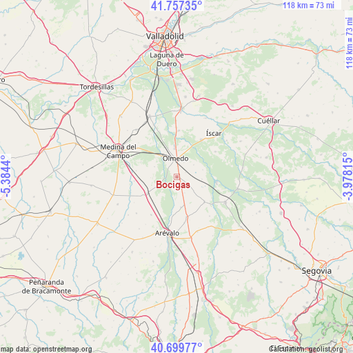
41° 13' 50.52" North, 4° 40' 52.608" West
| Map corner | latitude | longitude |
|---|---|---|
| Upper-left | 41.75735°, | -5.3844° |
| Center: | 41.2307°, | -4.68128° |
| Lower-right: | 40.69977°, | -3.97815° |
| Map W x H: | 117.6×117.6 km | = 73.1×73.1mi |
| max Lat: | 43.74134° ⇑46% North |
| Bocigas: | 41.2307° |
| min Lat: | ⇓54% South 27.64134° |
| min Long | Bocigas | max Long |
| -18.00367° | -4.68128° | 4.2899° |
| W 31.6%⇐ | ⇒68.4% E |
Elevation
Elevation of Bocigas is 773 m = 2536 ft, and this is 175 m = 574 ft above average elevation for this country.
| Max E: |
1682 m = 5518 ft | 35.7% |
| Bocigas | 773 m 2536 ft | |
| Avg. | 598 m = 1962 ft | |
Min E: |
0 m = 0 ft | 64.3% |
See also: Spain elevation on elevation.city.
Geographical zone
Bocigas is located in North temperate zone (between Tropic of Cancer and the Arctic Circle). Distance of this Northern Tropic circle is 1978.5 km =1229.4 mi to South.| Distance of | km | miles | from Bocigas |
|---|---|---|---|
| North Pole | 5422.6 | 3369.4 | to North |
| Arctic Circle | 2816.7 | 1750.2 | to North |
| Tropic Cancer | 1978.5 | 1229.4 | to South |
| Equator | 4584.4 | 2848.6 | to South |


Nearby cities:
15 places around Bocigas: (largest is in red/bold)
• Aguasal
5.5 km =3.4 mi,  25°
25°
• Almenara de Adaja
1.9 km =1.2 mi,  172°
172°
• Ataquines
11.5 km =7.1 mi,  242°
242°
• Donhierro
12.8 km =8 mi,  185°
185°
• Fuente de Santa Cruz
4.5 km =2.8 mi,  121°
121°
• Llano de Olmedo
6.9 km =4.3 mi,  54°
54°
• Montejo de Arévalo
10.2 km =6.3 mi, 171°
• Moraleja de las Panaderas
13.1 km =8.1 mi,  292°
292°
• Olmedo
6.3 km =3.9 mi,  354°
354°
• Puras
5.9 km =3.7 mi,  153°
153°
• Ramiro
8.8 km =5.5 mi,  268°
268°
• San Pablo de la Moraleja
11.2 km =7 mi,  226°
226°
• Santiuste de San Juan Bautista
12.4 km =7.7 mi,  132°
132°
• Tolocirio
11 km =6.8 mi, 166°
• Villeguillo
8.9 km =5.5 mi,  73°
73°
Sources, notices
• [Note1] Compared only with cities in Spain existing in our database
• [Src1] Map data: © OpenStreetMap contributors (CC-BY-SA)
• [Src2] Other city data from geonames.org with taken over terms of usage.
• [Src3] Geographical zone / Annual Mean Temperature by Robert A. Rohde @ Wikipedia
