Santurtzi geodata
Santurtzi (Basque Country) is a seat of a third-order administrative division; located in Spain in Europe/Madrid (GMT+2) time zone. With population of 46,978 people, there are 188 cities with bigger population in this country. Compared to other cities in Spain, 98% of cities are located further ↓South; 53.9% of cities are located further ←West and 97.6% of cities have higher elevation than Santurtzi. Note1


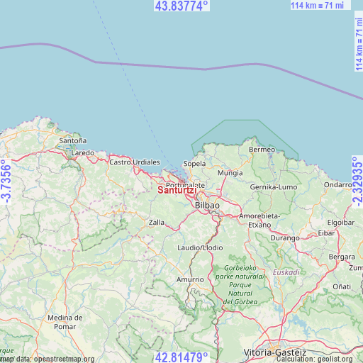
Santurtzi GPS coordinates[2]
43° 19' 42.312" North, 3° 1' 56.928" West
| Map corner | latitude | longitude |
|---|---|---|
| Upper-left | 43.83774°, | -3.7356° |
| Center: | 43.32842°, | -3.03248° |
| Lower-right: | 42.81479°, | -2.32935° |
| Map W x H: | 113.7×113.7 km | = 70.6×70.6mi |
| max Lat: | 43.74134° ⇑2% North |
| Santurtzi: | 43.32842° |
| min Lat: | ⇓98% South 27.64134° |
| min Long | Santurtzi | max Long |
| -18.00367° | -3.03248° | 4.2899° |
| W 53.9%⇐ | ⇒46.1% E |
Elevation
Elevation of Santurtzi is 13 m = 43 ft, and this is 585 m = 1919 ft below average elevation for this country.
| Max E: |
1682 m = 5518 ft | 97.6% |
| Avg. | 598 m = 1962 ft | |
| Santurtzi | 13 m = 43 ft | |
Min E: |
0 m = 0 ft | 2.4% |
See also: Santurtzi elevation on elevation.city.
Geographical zone
Santurtzi is located in North temperate zone (between Tropic of Cancer and the Arctic Circle). Distance of this Northern Tropic circle is 2211.7 km =1374.3 mi to South.| Distance of | km | miles | from Santurtzi |
|---|---|---|---|
| North Pole | 5189.4 | 3224.5 | to North |
| Arctic Circle | 2583.5 | 1605.3 | to North |
| Tropic Cancer | 2211.7 | 1374.3 | to South |
| Equator | 4817.7 | 2993.6 | to South |


Nearby cities:
15 places around Santurtzi: (largest is in red/bold)
• Algorta
3 km =1.9 mi,  38°
38°
• Barakaldo
5.1 km =3.2 mi,  134°
134°
• Berango
5 km =3.1 mi, 35°
• Erandio
5.5 km =3.4 mi,  119°
119°
• Erandiogoikoa
6.7 km =4.2 mi,  110°
110°
• Getxo
3.6 km =2.2 mi,  28°
28°
• Landa
9 km =5.6 mi,  47°
47°
• Leioa
3.5 km =2.2 mi,  92°
92°
• Ortuella
2.7 km =1.7 mi,  224°
224°
• Portugalete
1.3 km =0.8 mi, 130°
• San Julián de Muskiz
5.5 km =3.4 mi,  275°
275°
• Sestao
2.9 km =1.8 mi,  135°
135°
• Sondika
9.3 km =5.8 mi, 109°
• Sopela
6.9 km =4.3 mi, 35°
• Zierbena
4.8 km =3 mi,  300°
300°
Sources, notices
• [Note1] Compared only with cities in Spain existing in our database
• [Src1] Map data: © OpenStreetMap contributors (CC-BY-SA)
• [Src2] Other city data from geonames.org with taken over terms of usage.
• [Src3] Geographical zone / Annual Mean Temperature by Robert A. Rohde @ Wikipedia
