San Sadurniño geodata
San Sadurniño (Galicia) is a seat of a third-order administrative division; located in Spain in Europe/Madrid (GMT+2) time zone. In our database, there are 6762 cities with bigger population. Compared to other cities in Spain, 99.6% of cities are located further ↓South; 96.5% of cities are located further →East and 87.5% of cities have higher elevation than San Sadurniño. Note1


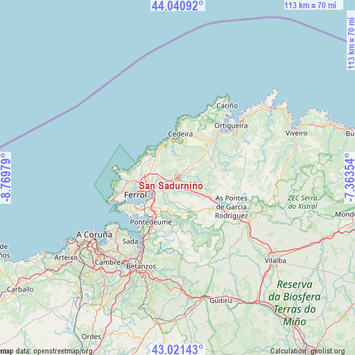
San Sadurniño GPS coordinates[2]
43° 31' 59.988" North, 8° 4' 0.012" West
| Map corner | latitude | longitude |
|---|---|---|
| Upper-left | 44.04092°, | -8.76979° |
| Center: | 43.53333°, | -8.06667° |
| Lower-right: | 43.02143°, | -7.36354° |
| Map W x H: | 113.4×113.4 km | = 70.5×70.5mi |
| max Lat: | 43.74134° ⇑0.4% North |
| San Sadurniño: | 43.53333° |
| min Lat: | ⇓99.6% South 27.64134° |
| min Long | San Sadurniño | max Long |
| -18.00367° | -8.06667° | 4.2899° |
| W 3.5%⇐ | ⇒96.5% E |
Elevation
Elevation of San Sadurniño is 101 m = 331 ft, and this is 497 m = 1631 ft below average elevation for this country.
| Max E: |
1682 m = 5518 ft | 87.5% |
| Avg. | 598 m = 1962 ft | |
| San Sadurniño | 101 m = 331 ft | |
Min E: |
0 m = 0 ft | 12.5% |
See also: Spain elevation on elevation.city.
Geographical zone
San Sadurniño is located in North temperate zone (between Tropic of Cancer and the Arctic Circle). Distance of this Northern Tropic circle is 2234.5 km =1388.5 mi to South.| Distance of | km | miles | from San Sadurniño |
|---|---|---|---|
| North Pole | 5166.6 | 3210.4 | to North |
| Arctic Circle | 2560.7 | 1591.1 | to North |
| Tropic Cancer | 2234.5 | 1388.5 | to South |
| Equator | 4840.5 | 3007.7 | to South |


Nearby cities:
15 places around San Sadurniño: (largest is in red/bold)
• Ares
18.3 km =11.4 mi,  230°
230°
• As Pontes de García Rodríguez
19.5 km =12.1 mi,  117°
117°
• Cedeira
14.2 km =8.8 mi,  3°
3°
• Cerdido
11.1 km =6.9 mi,  29°
29°
• Fene
11.4 km =7.1 mi,  215°
215°
• Ferrol
13.2 km =8.2 mi,  248°
248°
• Franza
15.2 km =9.4 mi, 232°
• Miño
23.1 km =14.4 mi,  207°
207°
• Moeche
4.4 km =2.7 mi,  65°
65°
• Monfero
22.6 km =14 mi,  169°
169°
• Mugardos
17.2 km =10.7 mi,  241°
241°
• Narón
10.6 km =6.6 mi, 250°
• Santa Marta de Ortigueira
24.1 km =15 mi,  46°
46°
• Somozas
10.7 km =6.6 mi,  90°
90°
• Valdoviño
9.2 km =5.7 mi,  324°
324°
Sources, notices
• [Note1] Compared only with cities in Spain existing in our database
• [Src1] Map data: © OpenStreetMap contributors (CC-BY-SA)
• [Src2] Other city data from geonames.org with taken over terms of usage.
• [Src3] Geographical zone / Annual Mean Temperature by Robert A. Rohde @ Wikipedia
