Sant Maurici de la Quar geodata
Sant Maurici de la Quar (Catalonia) is a populated place; located in Spain in Europe/Madrid (GMT+2) time zone. With population of 900 people, there are 3067 cities with bigger population in this country. Compared to other cities in Spain, 76.1% of cities are located further ↓South; 93.3% of cities are located further ←West and 81.5% of cities have lower elevation than Sant Maurici de la Quar. Note1
Current local time in Sant Maurici de la Quar:
12:02 AM, FridayDifference from your time zone: hours


Sant Maurici de la Quar GPS coordinates[2]
42° 4' 59.988" North, 1° 58' 0.012" East
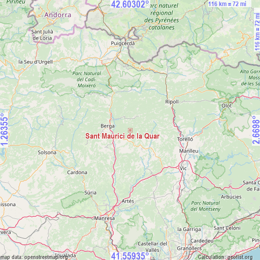
| Map corner | latitude | longitude |
|---|---|---|
| Upper-left | 42.60302°, | 1.26355° |
| Center: | 42.08333°, | 1.96667° |
| Lower-right: | 41.55935°, | 2.6698° |
| Map W x H: | 116×116 km | = 72.1×72.1mi |
| max Lat: | 43.74134° ⇑23.9% North |
| Sant Maurici de la Quar: | 42.08333° |
| min Lat: | ⇓76.1% South 27.64134° |
| min Long | Sant Maurici de | max Long |
| -18.00367° | 1.96667° | 4.2899° |
| W 93.3%⇐ | ⇒6.7% E |
Elevation
Elevation of Sant Maurici de la Quar is 912 m = 2992 ft, and this is 314 m = 1030 ft above average elevation for this country.
| Max E: |
1682 m = 5518 ft | 18.5% |
| Sant Maurici de la Quar | 912 m 2992 ft | |
| Avg. | 598 m = 1962 ft | |
Min E: |
0 m = 0 ft | 81.5% |
See also: Spain elevation on elevation.city.
Geographical zone
Sant Maurici de la Quar is located in North temperate zone (between Tropic of Cancer and the Arctic Circle). Distance of this Northern Tropic circle is 2073.3 km =1288.3 mi to South.| Distance of | km | miles | from Sant Maurici de la Quar |
|---|---|---|---|
| North Pole | 5327.8 | 3310.5 | to North |
| Arctic Circle | 2721.9 | 1691.3 | to North |
| Tropic Cancer | 2073.3 | 1288.3 | to South |
| Equator | 4679.2 | 2907.5 | to South |


Nearby cities:
15 places around Sant Maurici de la Quar: (largest is in red/bold)
• Alpens
11.8 km =7.3 mi,  70°
70°
• Avià
9.8 km =6.1 mi,  259°
259°
• Berga
10.2 km =6.3 mi,  283°
283°
• Borredà
6.2 km =3.9 mi,  21°
21°
• Gironella
9 km =5.6 mi,  232°
232°
• Olost
15.2 km =9.4 mi,  135°
135°
• Olvan
5.8 km =3.6 mi,  251°
251°
• Prats de Lluçanès
9.2 km =5.7 mi, 143°
• Puig-reig
14.7 km =9.1 mi,  207°
207°
• Sagàs
3.7 km =2.3 mi,  180°
180°
• Sant Boi de Lluçanès
15.6 km =9.7 mi,  103°
103°
• Sant Feliu Sasserra
15.8 km =9.8 mi,  159°
159°
• Sora
16.3 km =10.1 mi,  78°
78°
• Vilada
6.6 km =4.1 mi,  334°
334°
• les Llosses
14.4 km =8.9 mi,  59°
59°
Sources, notices
• [Note1] Compared only with cities in Spain existing in our database
• [Src1] Map data: © OpenStreetMap contributors (CC-BY-SA)
• [Src2] Other city data from geonames.org with taken over terms of usage.
• [Src3] Geographical zone / Annual Mean Temperature by Robert A. Rohde @ Wikipedia
