Gironella geodata
Gironella (Catalonia) is a populated place; located in Spain in Europe/Madrid (GMT+2) time zone. With population of 4,867 people, there are 1334 cities with bigger population in this country. Compared to other cities in Spain, 74.7% of cities are located further ↓South; 93% of cities are located further ←West and 65.4% of cities have higher elevation than Gironella. Note1


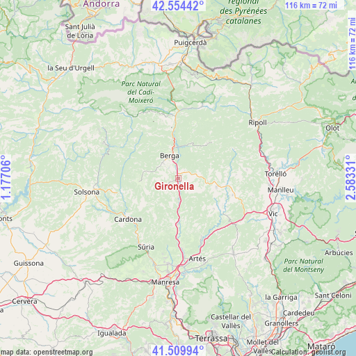
Gironella GPS coordinates[2]
42° 2' 3.588" North, 1° 52' 48.684" East
| Map corner | latitude | longitude |
|---|---|---|
| Upper-left | 42.55442°, | 1.17706° |
| Center: | 42.03433°, | 1.88019° |
| Lower-right: | 41.50994°, | 2.58331° |
| Map W x H: | 116.1×116.1 km | = 72.1×72.1mi |
| max Lat: | 43.74134° ⇑25.3% North |
| Gironella: | 42.03433° |
| min Lat: | ⇓74.7% South 27.64134° |
| min Long | Gironella | max Long |
| -18.00367° | 1.88019° | 4.2899° |
| W 93%⇐ | ⇒7% E |
Elevation
Elevation of Gironella is 455 m = 1493 ft, and this is 143 m = 469 ft below average elevation for this country.
| Max E: |
1682 m = 5518 ft | 65.4% |
| Avg. | 598 m = 1962 ft | |
| Gironella | 455 m = 1493 ft | |
Min E: |
0 m = 0 ft | 34.6% |
See also: Spain elevation on elevation.city.
Geographical zone
Gironella is located in North temperate zone (between Tropic of Cancer and the Arctic Circle). Distance of this Northern Tropic circle is 2067.9 km =1284.9 mi to South.| Distance of | km | miles | from Gironella |
|---|---|---|---|
| North Pole | 5333.3 | 3314 | to North |
| Arctic Circle | 2727.4 | 1694.7 | to North |
| Tropic Cancer | 2067.9 | 1284.9 | to South |
| Equator | 4673.8 | 2904.2 | to South |


Nearby cities:
15 places around Gironella: (largest is in red/bold)
• Avià
4.4 km =2.7 mi,  325°
325°
• Balsareny
19 km =11.8 mi,  181°
181°
• Berga
8.3 km =5.2 mi,  340°
340°
• Borredà
14.7 km =9.1 mi,  39°
39°
• Capolat
11.5 km =7.1 mi,  294°
294°
• Castellar del Riu
13.2 km =8.2 mi,  318°
318°
• Navàs
14.9 km =9.3 mi, 180°
• Olost
18.5 km =11.5 mi,  107°
107°
• Olvan
4 km =2.5 mi,  24°
24°
• Prats de Lluçanès
12.8 km =8 mi,  98°
98°
• Puig-reig
7.5 km =4.7 mi, 178°
• Sagàs
7.4 km =4.6 mi,  76°
76°
• Sant Feliu Sasserra
15.8 km =9.8 mi,  126°
126°
• Sant Maurici de la Quar
9 km =5.6 mi,  52°
52°
• Vilada
12.2 km =7.6 mi, 20°
Sources, notices
• [Note1] Compared only with cities in Spain existing in our database
• [Src1] Map data: © OpenStreetMap contributors (CC-BY-SA)
• [Src2] Other city data from geonames.org with taken over terms of usage.
• [Src3] Geographical zone / Annual Mean Temperature by Robert A. Rohde @ Wikipedia
