Sangarcía geodata
Sangarcía (Castille and León) is a seat of a third-order administrative division; located in Spain in Europe/Madrid (GMT+2) time zone. With population of 445 people, there are 4018 cities with bigger population in this country. Compared to other cities in Spain, 52.8% of cities are located further ↑North; 65.1% of cities are located further →East and 84.2% of cities have lower elevation than Sangarcía. Note1
Administrative division(s):
- Level 1: Castille and León
- Level 2: Provincia de Segovia
- Level 3: Sangarcía


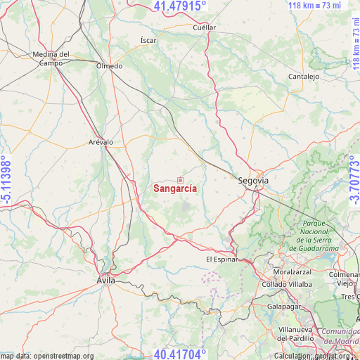
Sangarcía GPS coordinates[2]
40° 57' 0.828" North, 4° 24' 39.06" West
| Map corner | latitude | longitude |
|---|---|---|
| Upper-left | 41.47915°, | -5.11398° |
| Center: | 40.95023°, | -4.41085° |
| Lower-right: | 40.41704°, | -3.70773° |
| Map W x H: | 118.1×118.1 km | = 73.4×73.4mi |
| max Lat: | 43.74134° ⇑52.8% North |
| Sangarcía: | 40.95023° |
| min Lat: | ⇓47.2% South 27.64134° |
| min Long | Sangarcía | max Long |
| -18.00367° | -4.41085° | 4.2899° |
| W 34.9%⇐ | ⇒65.1% E |
Elevation
Elevation of Sangarcía is 942 m = 3091 ft, and this is 344 m = 1129 ft above average elevation for this country.
| Max E: |
1682 m = 5518 ft | 15.8% |
| Sangarcía | 942 m 3091 ft | |
| Avg. | 598 m = 1962 ft | |
Min E: |
0 m = 0 ft | 84.2% |
See also: Spain elevation on elevation.city.
Geographical zone
Sangarcía is located in North temperate zone (between Tropic of Cancer and the Arctic Circle). Distance of this Northern Tropic circle is 1947.3 km =1210 mi to South.| Distance of | km | miles | from Sangarcía |
|---|---|---|---|
| North Pole | 5453.8 | 3388.8 | to North |
| Arctic Circle | 2847.9 | 1769.6 | to North |
| Tropic Cancer | 1947.3 | 1210 | to South |
| Equator | 4553.2 | 2829.2 | to South |


Nearby cities:
15 places around Sangarcía: (largest is in red/bold)
• Abades
12.5 km =7.8 mi,  107°
107°
• Anaya
9.7 km =6 mi,  61°
61°
• Añe
13.7 km =8.5 mi,  45°
45°
• Bercial
5.3 km =3.3 mi,  204°
204°
• Garcillán
12.6 km =7.8 mi,  75°
75°
• Juarros de Voltoya
12.8 km =8 mi,  314°
314°
• Lastras del Pozo
9.6 km =6 mi,  145°
145°
• Marazoleja
6.2 km =3.9 mi, 78°
• Marazuela
5 km =3.1 mi, 50°
• Martín Miguel
11.7 km =7.3 mi,  88°
88°
• Marugán
6.1 km =3.8 mi,  158°
158°
• Melque de Cercos
12.3 km =7.6 mi,  336°
336°
• Monterrubio
12.3 km =7.6 mi, 155°
• Muñopedro
8.6 km =5.3 mi,  216°
216°
• Santa María la Real de Nieva
13.3 km =8.3 mi,  1°
1°
Sources, notices
• [Note1] Compared only with cities in Spain existing in our database
• [Src1] Map data: © OpenStreetMap contributors (CC-BY-SA)
• [Src2] Other city data from geonames.org with taken over terms of usage.
• [Src3] Geographical zone / Annual Mean Temperature by Robert A. Rohde @ Wikipedia
