Abades geodata
Abades (Castille and León) is a seat of a third-order administrative division; located in Spain in Europe/Madrid (GMT+2) time zone. With population of 907 people, there are 3061 cities with bigger population in this country. Compared to other cities in Spain, 53.5% of cities are located further ↑North; 63.5% of cities are located further →East and 86.4% of cities have lower elevation than Abades. Note1
Administrative division(s):
- Level 1: Castille and León
- Level 2: Provincia de Segovia
- Level 3: Abades


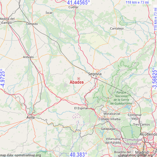
Abades GPS coordinates[2]
40° 54' 59.256" North, 4° 16' 9.732" West
| Map corner | latitude | longitude |
|---|---|---|
| Upper-left | 41.44565°, | -4.9725° |
| Center: | 40.91646°, | -4.26937° |
| Lower-right: | 40.383°, | -3.56625° |
| Map W x H: | 118.2×118.2 km | = 73.4×73.4mi |
| max Lat: | 43.74134° ⇑53.5% North |
| Abades: | 40.91646° |
| min Lat: | ⇓46.5% South 27.64134° |
| min Long | Abades | max Long |
| -18.00367° | -4.26937° | 4.2899° |
| W 36.5%⇐ | ⇒63.5% E |
Elevation
Elevation of Abades is 970 m = 3182 ft, and this is 372 m = 1220 ft above average elevation for this country.
| Max E: |
1682 m = 5518 ft | 13.6% |
| Abades | 970 m 3182 ft | |
| Avg. | 598 m = 1962 ft | |
Min E: |
0 m = 0 ft | 86.4% |
See also: Spain elevation on elevation.city.
Geographical zone
Abades is located in North temperate zone (between Tropic of Cancer and the Arctic Circle). Distance of this Northern Tropic circle is 1943.6 km =1207.7 mi to South.| Distance of | km | miles | from Abades |
|---|---|---|---|
| North Pole | 5457.6 | 3391.2 | to North |
| Arctic Circle | 2851.7 | 1772 | to North |
| Tropic Cancer | 1943.6 | 1207.7 | to South |
| Equator | 4549.5 | 2826.9 | to South |


Nearby cities:
15 places around Abades: (largest is in red/bold)
• Anaya
9 km =5.6 mi,  338°
338°
• Garcillán
6.8 km =4.2 mi,  2°
2°
• Hontanares de Eresma
9.2 km =5.7 mi,  36°
36°
• Lastras del Pozo
7.7 km =4.8 mi,  237°
237°
• Marazoleja
7.6 km =4.7 mi,  310°
310°
• Marazuela
10.6 km =6.6 mi, 310°
• Martín Miguel
4 km =2.5 mi,  357°
357°
• Marugán
9.8 km =6.1 mi,  258°
258°
• Monterrubio
10.1 km =6.3 mi,  222°
222°
• Ortigosa del Monte
11.4 km =7.1 mi,  136°
136°
• Otero de Herreros
11.8 km =7.3 mi,  154°
154°
• Sangarcía
12.5 km =7.8 mi,  287°
287°
• Valdeprados
11 km =6.8 mi,  174°
174°
• Valseca
12.1 km =7.5 mi, 40°
• Valverde del Majano
5.4 km =3.4 mi,  32°
32°
Sources, notices
• [Note1] Compared only with cities in Spain existing in our database
• [Src1] Map data: © OpenStreetMap contributors (CC-BY-SA)
• [Src2] Other city data from geonames.org with taken over terms of usage.
• [Src3] Geographical zone / Annual Mean Temperature by Robert A. Rohde @ Wikipedia
