Marazuela geodata
Marazuela (Castille and León) is a seat of a third-order administrative division; located in Spain in Europe/Madrid (GMT+2) time zone. With population of 57 people, there are 6380 cities with bigger population in this country. Compared to other cities in Spain, 52.1% of cities are located further ↑North; 64.5% of cities are located further →East and 81.3% of cities have lower elevation than Marazuela. Note1
Administrative division(s):
- Level 1: Castille and León
- Level 2: Provincia de Segovia
- Level 3: Marazuela


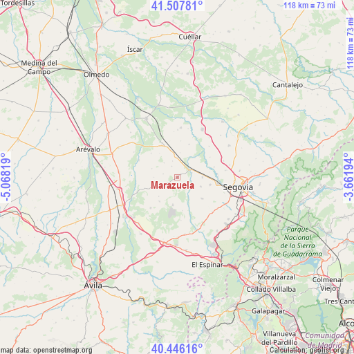
Marazuela GPS coordinates[2]
40° 58' 44.832" North, 4° 21' 54.216" West
| Map corner | latitude | longitude |
|---|---|---|
| Upper-left | 41.50781°, | -5.06819° |
| Center: | 40.97912°, | -4.36506° |
| Lower-right: | 40.44616°, | -3.66194° |
| Map W x H: | 118×118 km | = 73.3×73.3mi |
| max Lat: | 43.74134° ⇑52.1% North |
| Marazuela: | 40.97912° |
| min Lat: | ⇓47.9% South 27.64134° |
| min Long | Marazuela | max Long |
| -18.00367° | -4.36506° | 4.2899° |
| W 35.5%⇐ | ⇒64.5% E |
Elevation
Elevation of Marazuela is 910 m = 2986 ft, and this is 312 m = 1024 ft above average elevation for this country.
| Max E: |
1682 m = 5518 ft | 18.7% |
| Marazuela | 910 m 2986 ft | |
| Avg. | 598 m = 1962 ft | |
Min E: |
0 m = 0 ft | 81.3% |
See also: Spain elevation on elevation.city.
Geographical zone
Marazuela is located in North temperate zone (between Tropic of Cancer and the Arctic Circle). Distance of this Northern Tropic circle is 1950.5 km =1212 mi to South.| Distance of | km | miles | from Marazuela |
|---|---|---|---|
| North Pole | 5450.6 | 3386.8 | to North |
| Arctic Circle | 2844.7 | 1767.6 | to North |
| Tropic Cancer | 1950.5 | 1212 | to South |
| Equator | 4556.5 | 2831.3 | to South |


Nearby cities:
15 places around Marazuela: (largest is in red/bold)
• Abades
10.6 km =6.6 mi,  130°
130°
• Anaya
4.9 km =3 mi,  73°
73°
• Armuña
11.6 km =7.2 mi,  19°
19°
• Añe
8.7 km =5.4 mi,  42°
42°
• Bercial
10 km =6.2 mi,  216°
216°
• Garcillán
8.3 km =5.2 mi,  91°
91°
• Lastras del Pozo
11.2 km =7 mi,  172°
172°
• Marazoleja
3 km =1.9 mi, 132°
• Martín Miguel
8.4 km =5.2 mi,  110°
110°
• Marugán
9 km =5.6 mi,  190°
190°
• Melque de Cercos
11.9 km =7.4 mi,  312°
312°
• Ortigosa de Pestaño
12.3 km =7.6 mi,  348°
348°
• Sangarcía
5 km =3.1 mi,  230°
230°
• Santa María la Real de Nieva
10.7 km =6.6 mi,  340°
340°
• Valverde del Majano
11.2 km =7 mi,  102°
102°
Sources, notices
• [Note1] Compared only with cities in Spain existing in our database
• [Src1] Map data: © OpenStreetMap contributors (CC-BY-SA)
• [Src2] Other city data from geonames.org with taken over terms of usage.
• [Src3] Geographical zone / Annual Mean Temperature by Robert A. Rohde @ Wikipedia
