Garcillán geodata
Garcillán (Castille and León) is a seat of a third-order administrative division; located in Spain in Europe/Madrid (GMT+2) time zone. With population of 382 people, there are 4197 cities with bigger population in this country. Compared to other cities in Spain, 52.1% of cities are located further ↑North; 63.4% of cities are located further →East and 82% of cities have lower elevation than Garcillán. Note1
Administrative division(s):
- Level 1: Castille and León
- Level 2: Provincia de Segovia
- Level 3: Garcillán


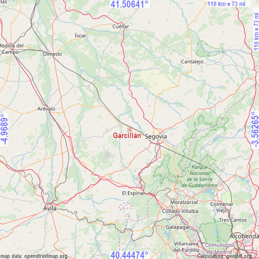
Garcillán GPS coordinates[2]
40° 58' 39.756" North, 4° 15' 56.772" West
| Map corner | latitude | longitude |
|---|---|---|
| Upper-left | 41.50641°, | -4.9689° |
| Center: | 40.97771°, | -4.26577° |
| Lower-right: | 40.44474°, | -3.56265° |
| Map W x H: | 118×118 km | = 73.3×73.3mi |
| max Lat: | 43.74134° ⇑52.1% North |
| Garcillán: | 40.97771° |
| min Lat: | ⇓47.9% South 27.64134° |
| min Long | Garcillán | max Long |
| -18.00367° | -4.26577° | 4.2899° |
| W 36.6%⇐ | ⇒63.4% E |
Elevation
Elevation of Garcillán is 917 m = 3009 ft, and this is 319 m = 1047 ft above average elevation for this country.
| Max E: |
1682 m = 5518 ft | 18% |
| Garcillán | 917 m 3009 ft | |
| Avg. | 598 m = 1962 ft | |
Min E: |
0 m = 0 ft | 82% |
See also: Spain elevation on elevation.city.
Geographical zone
Garcillán is located in North temperate zone (between Tropic of Cancer and the Arctic Circle). Distance of this Northern Tropic circle is 1950.4 km =1211.9 mi to South.| Distance of | km | miles | from Garcillán |
|---|---|---|---|
| North Pole | 5450.8 | 3387 | to North |
| Arctic Circle | 2844.9 | 1767.7 | to North |
| Tropic Cancer | 1950.4 | 1211.9 | to South |
| Equator | 4556.3 | 2831.2 | to South |


Nearby cities:
15 places around Garcillán: (largest is in red/bold)
• Abades
6.8 km =4.2 mi,  182°
182°
• Anaya
4 km =2.5 mi,  293°
293°
• Armuña
11.9 km =7.4 mi,  337°
337°
• Añe
7 km =4.3 mi, 339°
• Encinillas
10.1 km =6.3 mi,  63°
63°
• Hontanares de Eresma
5.2 km =3.2 mi,  83°
83°
• Marazoleja
6.4 km =4 mi,  253°
253°
• Marazuela
8.3 km =5.2 mi,  271°
271°
• Martín Miguel
2.9 km =1.8 mi,  189°
189°
• Roda de Eresma
9.1 km =5.7 mi,  51°
51°
• Sangarcía
12.6 km =7.8 mi,  255°
255°
• Segovia
12.8 km =8 mi,  104°
104°
• Valseca
8 km =5 mi,  72°
72°
• Valverde del Majano
3.5 km =2.2 mi,  131°
131°
• Yanguas de Eresma
10.7 km =6.6 mi,  12°
12°
Sources, notices
• [Note1] Compared only with cities in Spain existing in our database
• [Src1] Map data: © OpenStreetMap contributors (CC-BY-SA)
• [Src2] Other city data from geonames.org with taken over terms of usage.
• [Src3] Geographical zone / Annual Mean Temperature by Robert A. Rohde @ Wikipedia
