Roturas geodata
Roturas (Castille and León) is a seat of a third-order administrative division; located in Spain in Europe/Madrid (GMT+2) time zone. With population of 32 people, there are 6640 cities with bigger population in this country. Compared to other cities in Spain, 65.2% of cities are located further ↓South; 61.5% of cities are located further →East and 72% of cities have lower elevation than Roturas. Note1
Administrative division(s):
- Level 1: Castille and León
- Level 2: Provincia de Valladolid
- Level 3: Roturas


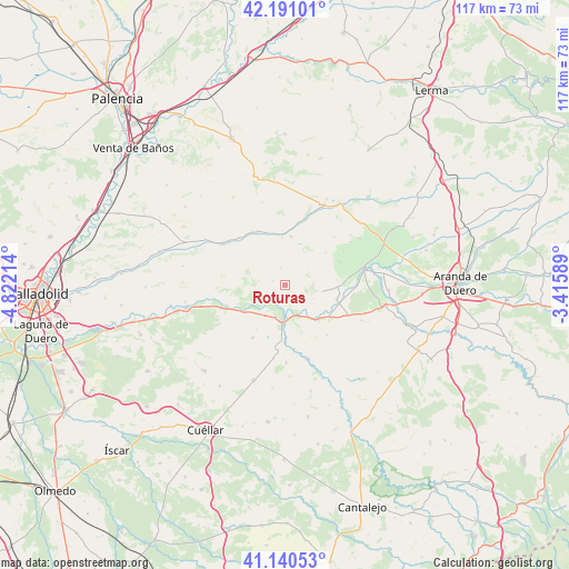
Roturas GPS coordinates[2]
41° 40' 4.476" North, 4° 7' 8.436" West
| Map corner | latitude | longitude |
|---|---|---|
| Upper-left | 42.19101°, | -4.82214° |
| Center: | 41.66791°, | -4.11901° |
| Lower-right: | 41.14053°, | -3.41589° |
| Map W x H: | 116.8×116.8 km | = 72.6×72.6mi |
| max Lat: | 43.74134° ⇑34.8% North |
| Roturas: | 41.66791° |
| min Lat: | ⇓65.2% South 27.64134° |
| min Long | Roturas | max Long |
| -18.00367° | -4.11901° | 4.2899° |
| W 38.5%⇐ | ⇒61.5% E |
Elevation
Elevation of Roturas is 827 m = 2713 ft, and this is 229 m = 751 ft above average elevation for this country.
| Max E: |
1682 m = 5518 ft | 28% |
| Roturas | 827 m 2713 ft | |
| Avg. | 598 m = 1962 ft | |
Min E: |
0 m = 0 ft | 72% |
See also: Spain elevation on elevation.city.
Geographical zone
Roturas is located in North temperate zone (between Tropic of Cancer and the Arctic Circle). Distance of this Northern Tropic circle is 2027.1 km =1259.6 mi to South.| Distance of | km | miles | from Roturas |
|---|---|---|---|
| North Pole | 5374 | 3339.2 | to North |
| Arctic Circle | 2768.1 | 1720 | to North |
| Tropic Cancer | 2027.1 | 1259.6 | to South |
| Equator | 4633 | 2878.8 | to South |


Nearby cities:
15 places around Roturas: (largest is in red/bold)
• Bocos de Duero
6.4 km =4 mi,  140°
140°
• Canillas de Esgueva
9.7 km =6 mi,  357°
357°
• Corrales de Duero
5.9 km =3.7 mi,  85°
85°
• Curiel de Duero
3.1 km =1.9 mi,  151°
151°
• Encinas de Esgueva
9.9 km =6.2 mi,  7°
7°
• Manzanillo
10.8 km =6.7 mi,  212°
212°
• Pesquera de Duero
4.2 km =2.6 mi,  226°
226°
• Peñafiel
7.4 km =4.6 mi,  176°
176°
• Piñel de Abajo
2.4 km =1.5 mi,  287°
287°
• Piñel de Arriba
3.6 km =2.2 mi,  347°
347°
• Quintanilla de Arriba
9.8 km =6.1 mi,  236°
236°
• San Llorente
4.9 km =3 mi,  65°
65°
• San Martín de Rubiales
11 km =6.8 mi,  105°
105°
• Valdearcos de la Vega
6.5 km =4 mi,  115°
115°
• Villaescusa de Roa
10.7 km =6.6 mi,  52°
52°
Sources, notices
• [Note1] Compared only with cities in Spain existing in our database
• [Src1] Map data: © OpenStreetMap contributors (CC-BY-SA)
• [Src2] Other city data from geonames.org with taken over terms of usage.
• [Src3] Geographical zone / Annual Mean Temperature by Robert A. Rohde @ Wikipedia
