Rollamienta geodata
Rollamienta (Castille and León) is a seat of a third-order administrative division; located in Spain in Europe/Madrid (GMT+2) time zone. With population of 49 people, there are 6475 cities with bigger population in this country. Compared to other cities in Spain, 71.5% of cities are located further ↓South; 60.6% of cities are located further ←West and 95.1% of cities have lower elevation than Rollamienta. Note1
Administrative division(s):
- Level 1: Castille and León
- Level 2: Provincia de Soria
- Level 3: Rollamienta


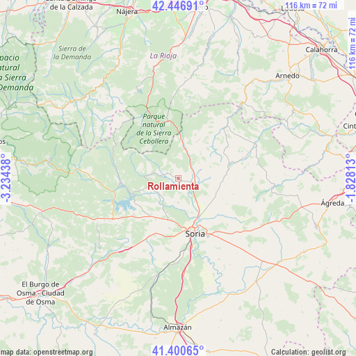
Rollamienta GPS coordinates[2]
41° 55' 33.312" North, 2° 31' 52.5" West
| Map corner | latitude | longitude |
|---|---|---|
| Upper-left | 42.44691°, | -3.23438° |
| Center: | 41.92592°, | -2.53125° |
| Lower-right: | 41.40065°, | -1.82813° |
| Map W x H: | 116.3×116.3 km | = 72.3×72.3mi |
| max Lat: | 43.74134° ⇑28.5% North |
| Rollamienta: | 41.92592° |
| min Lat: | ⇓71.5% South 27.64134° |
| min Long | Rollamienta | max Long |
| -18.00367° | -2.53125° | 4.2899° |
| W 60.6%⇐ | ⇒39.4% E |
Elevation
Elevation of Rollamienta is 1141 m = 3743 ft, and this is 543 m = 1781 ft above average elevation for this country.
| Max E: |
1682 m = 5518 ft | 4.9% |
| Rollamienta | 1141 m 3743 ft | |
| Avg. | 598 m = 1962 ft | |
Min E: |
0 m = 0 ft | 95.1% |
See also: Spain elevation on elevation.city.
Geographical zone
Rollamienta is located in North temperate zone (between Tropic of Cancer and the Arctic Circle). Distance of this Northern Tropic circle is 2055.8 km =1277.4 mi to South.| Distance of | km | miles | from Rollamienta |
|---|---|---|---|
| North Pole | 5345.3 | 3321.4 | to North |
| Arctic Circle | 2739.4 | 1702.2 | to North |
| Tropic Cancer | 2055.8 | 1277.4 | to South |
| Equator | 4661.7 | 2896.6 | to South |


Nearby cities:
15 places around Rollamienta: (largest is in red/bold)
• Almarza
5.6 km =3.5 mi,  65°
65°
• Arévalo de la Sierra
11.1 km =6.9 mi,  77°
77°
• Ausejo de la Sierra
13.5 km =8.4 mi,  104°
104°
• Buitrago
13.4 km =8.3 mi,  130°
130°
• Cidones
15.3 km =9.5 mi,  215°
215°
• Estepa de San Juan
16.4 km =10.2 mi,  89°
89°
• Fuentecantos
12 km =7.5 mi,  135°
135°
• Fuentelsaz de Soria
11.7 km =7.3 mi,  124°
124°
• Garray
14.1 km =8.8 mi,  149°
149°
• Renieblas
17.7 km =11 mi, 131°
• Santa Cruz de Yanguas
16.6 km =10.3 mi,  24°
24°
• Sotillo del Rincón
6 km =3.7 mi,  276°
276°
• Valdeavellano de Tera
4.2 km =2.6 mi,  296°
296°
• Villar del Ala
3.1 km =1.9 mi,  250°
250°
• Vizmanos
14.8 km =9.2 mi,  43°
43°
Sources, notices
• [Note1] Compared only with cities in Spain existing in our database
• [Src1] Map data: © OpenStreetMap contributors (CC-BY-SA)
• [Src2] Other city data from geonames.org with taken over terms of usage.
• [Src3] Geographical zone / Annual Mean Temperature by Robert A. Rohde @ Wikipedia
