Rábano de Aliste geodata
Rábano de Aliste (Castille and León) is a seat of a third-order administrative division; located in Spain in Europe/Madrid (GMT+2) time zone. With population of 444 people, there are 4019 cities with bigger population in this country. Compared to other cities in Spain, 67.1% of cities are located further ↓South; 90.7% of cities are located further →East and 67.9% of cities have lower elevation than Rábano de Aliste. Note1
Administrative division(s):
- Level 1: Castille and León
- Level 2: Provincia de Zamora
- Level 3: Rábano de Aliste


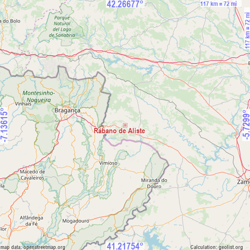
Rábano de Aliste GPS coordinates[2]
41° 44' 39.48" North, 6° 25' 58.872" West
| Map corner | latitude | longitude |
|---|---|---|
| Upper-left | 42.26677°, | -7.13615° |
| Center: | 41.7443°, | -6.43302° |
| Lower-right: | 41.21754°, | -5.7299° |
| Map W x H: | 116.7×116.7 km | = 72.5×72.5mi |
| max Lat: | 43.74134° ⇑32.9% North |
| Rábano de Aliste: | 41.7443° |
| min Lat: | ⇓67.1% South 27.64134° |
| min Long | Rábano de Alis | max Long |
| -18.00367° | -6.43302° | 4.2899° |
| W 9.3%⇐ | ⇒90.7% E |
Elevation
Elevation of Rábano de Aliste is 798 m = 2618 ft, and this is 200 m = 656 ft above average elevation for this country.
| Max E: |
1682 m = 5518 ft | 32.1% |
| Rábano de Aliste | 798 m 2618 ft | |
| Avg. | 598 m = 1962 ft | |
Min E: |
0 m = 0 ft | 67.9% |
See also: Spain elevation on elevation.city.
Geographical zone
Rábano de Aliste is located in North temperate zone (between Tropic of Cancer and the Arctic Circle). Distance of this Northern Tropic circle is 2035.6 km =1264.9 mi to South.| Distance of | km | miles | from Rábano de Aliste |
|---|---|---|---|
| North Pole | 5365.5 | 3334 | to North |
| Arctic Circle | 2759.6 | 1714.7 | to North |
| Tropic Cancer | 2035.6 | 1264.9 | to South |
| Equator | 4641.5 | 2884.1 | to South |


Nearby cities:
15 places around Rábano de Aliste: (largest is in red/bold)
• Alcañices
8.7 km =5.4 mi,  124°
124°
• Ferreras de Arriba
26.2 km =16.3 mi,  48°
48°
• Figueruela de Arriba
13.9 km =8.6 mi,  356°
356°
• Fonfría
27.1 km =16.8 mi, 116°
• Gallegos del Río
21.5 km =13.4 mi,  92°
92°
• Mahide
14.6 km =9.1 mi,  18°
18°
• Rabanales
13 km =8.1 mi, 90°
• Ríofrío de Aliste
22.7 km =14.1 mi,  69°
69°
• Samir de los Caños
23.7 km =14.7 mi,  109°
109°
• San Vicente de la Cabeza
16.7 km =10.4 mi, 65°
• San Vitero
7.9 km =4.9 mi,  62°
62°
• Trabazos
4.8 km =3 mi,  274°
274°
• Vegalatrave
27.5 km =17.1 mi,  100°
100°
• Villardeciervos
25.1 km =15.6 mi,  28°
28°
• Viñas
4.5 km =2.8 mi,  315°
315°
Sources, notices
• [Note1] Compared only with cities in Spain existing in our database
• [Src1] Map data: © OpenStreetMap contributors (CC-BY-SA)
• [Src2] Other city data from geonames.org with taken over terms of usage.
• [Src3] Geographical zone / Annual Mean Temperature by Robert A. Rohde @ Wikipedia
