Villardeciervos geodata
Villardeciervos (Castille and León) is a seat of a third-order administrative division; located in Spain in Europe/Madrid (GMT+2) time zone. With population of 514 people, there are 3836 cities with bigger population in this country. Compared to other cities in Spain, 72% of cities are located further ↓South; 89.3% of cities are located further →East and 75.5% of cities have lower elevation than Villardeciervos. Note1
Administrative division(s):
- Level 1: Castille and León
- Level 2: Provincia de Zamora
- Level 3: Villardeciervos


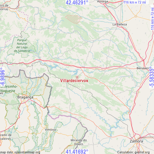
Villardeciervos GPS coordinates[2]
41° 56' 31.416" North, 6° 17' 11.292" West
| Map corner | latitude | longitude |
|---|---|---|
| Upper-left | 42.46291°, | -6.9896° |
| Center: | 41.94206°, | -6.28647° |
| Lower-right: | 41.41692°, | -5.58335° |
| Map W x H: | 116.3×116.3 km | = 72.3×72.3mi |
| max Lat: | 43.74134° ⇑28% North |
| Villardeciervos: | 41.94206° |
| min Lat: | ⇓72% South 27.64134° |
| min Long | Villardeciervos | max Long |
| -18.00367° | -6.28647° | 4.2899° |
| W 10.7%⇐ | ⇒89.3% E |
Elevation
Elevation of Villardeciervos is 856 m = 2808 ft, and this is 258 m = 846 ft above average elevation for this country.
| Max E: |
1682 m = 5518 ft | 24.5% |
| Villardeciervos | 856 m 2808 ft | |
| Avg. | 598 m = 1962 ft | |
Min E: |
0 m = 0 ft | 75.5% |
See also: Spain elevation on elevation.city.
Geographical zone
Villardeciervos is located in North temperate zone (between Tropic of Cancer and the Arctic Circle). Distance of this Northern Tropic circle is 2057.6 km =1278.5 mi to South.| Distance of | km | miles | from Villardeciervos |
|---|---|---|---|
| North Pole | 5343.5 | 3320.3 | to North |
| Arctic Circle | 2737.7 | 1701.1 | to North |
| Tropic Cancer | 2057.6 | 1278.5 | to South |
| Equator | 4663.5 | 2897.8 | to South |


Nearby cities:
15 places around Villardeciervos: (largest is in red/bold)
• Calzadilla de Tera
17.4 km =10.8 mi,  76°
76°
• Cernadilla
13.9 km =8.6 mi,  309°
309°
• Ferreras de Abajo
17.9 km =11.1 mi,  106°
106°
• Ferreras de Arriba
9 km =5.6 mi,  122°
122°
• Figueruela de Arriba
15.4 km =9.6 mi,  238°
238°
• Mahide
11.1 km =6.9 mi,  223°
223°
• Manzanal de Arriba
13.9 km =8.6 mi,  293°
293°
• Manzanal de los Infantes
14.8 km =9.2 mi,  327°
327°
• Molezuelas de la Carballeda
17.6 km =10.9 mi,  27°
27°
• Mombuey
9.7 km =6 mi,  338°
338°
• Otero de Bodas
11.3 km =7 mi,  91°
91°
• Peque
14.6 km =9.1 mi,  3°
3°
• Ríofrío de Aliste
16.6 km =10.3 mi,  146°
146°
• San Vicente de la Cabeza
15.3 km =9.5 mi,  168°
168°
• Vega de Tera
14.7 km =9.1 mi,  65°
65°
Sources, notices
• [Note1] Compared only with cities in Spain existing in our database
• [Src1] Map data: © OpenStreetMap contributors (CC-BY-SA)
• [Src2] Other city data from geonames.org with taken over terms of usage.
• [Src3] Geographical zone / Annual Mean Temperature by Robert A. Rohde @ Wikipedia
