Quicena geodata
Quicena (Aragon) is a seat of a third-order administrative division; located in Spain in Europe/Madrid (GMT+2) time zone. With population of 271 people, there are 4626 cities with bigger population in this country. Compared to other cities in Spain, 77.8% of cities are located further ↓South; 83.8% of cities are located further ←West and 63.7% of cities have higher elevation than Quicena. Note1


Quicena GPS coordinates[2]
42° 8' 52.692" North, 0° 21' 37.764" West
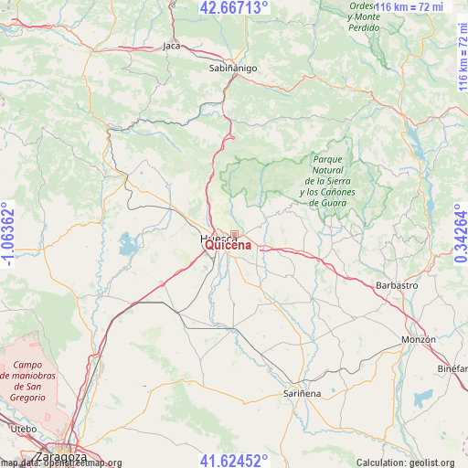
| Map corner | latitude | longitude |
|---|---|---|
| Upper-left | 42.66713°, | -1.06362° |
| Center: | 42.14797°, | -0.36049° |
| Lower-right: | 41.62452°, | 0.34264° |
| Map W x H: | 115.9×115.9 km | = 72×72mi |
| max Lat: | 43.74134° ⇑22.2% North |
| Quicena: | 42.14797° |
| min Lat: | ⇓77.8% South 27.64134° |
| min Long | Quicena | max Long |
| -18.00367° | -0.36049° | 4.2899° |
| W 83.8%⇐ | ⇒16.2% E |
Elevation
Elevation of Quicena is 477 m = 1565 ft, and this is 121 m = 397 ft below average elevation for this country.
| Max E: |
1682 m = 5518 ft | 63.7% |
| Avg. | 598 m = 1962 ft | |
| Quicena | 477 m = 1565 ft | |
Min E: |
0 m = 0 ft | 36.3% |
See also: Spain elevation on elevation.city.
Geographical zone
Quicena is located in North temperate zone (between Tropic of Cancer and the Arctic Circle). Distance of this Northern Tropic circle is 2080.5 km =1292.8 mi to South.| Distance of | km | miles | from Quicena |
|---|---|---|---|
| North Pole | 5320.6 | 3306.1 | to North |
| Arctic Circle | 2714.8 | 1686.9 | to North |
| Tropic Cancer | 2080.5 | 1292.8 | to South |
| Equator | 4686.4 | 2912 | to South |


Nearby cities:
15 places around Quicena: (largest is in red/bold)
• Albero Alto
11 km =6.8 mi,  169°
169°
• Albero Bajo
13.9 km =8.6 mi,  186°
186°
• Alcalá del Obispo
9.7 km =6 mi,  143°
143°
• Alerre
8.7 km =5.4 mi,  282°
282°
• Argavieso
12.6 km =7.8 mi,  147°
147°
• Banastás
8.4 km =5.2 mi,  295°
295°
• Chimillas
7.9 km =4.9 mi,  288°
288°
• Huesca
4.2 km =2.6 mi,  251°
251°
• Ibieca
12.6 km =7.8 mi,  83°
83°
• Igriés
9.5 km =5.9 mi,  321°
321°
• Loporzano
3.4 km =2.1 mi,  64°
64°
• Novales
14.2 km =8.8 mi, 154°
• Nueno
14.7 km =9.1 mi,  333°
333°
• Siétamo
7.1 km =4.4 mi,  112°
112°
• Tierz
1.7 km =1.1 mi,  163°
163°
Sources, notices
• [Note1] Compared only with cities in Spain existing in our database
• [Src1] Map data: © OpenStreetMap contributors (CC-BY-SA)
• [Src2] Other city data from geonames.org with taken over terms of usage.
• [Src3] Geographical zone / Annual Mean Temperature by Robert A. Rohde @ Wikipedia
