Porrera geodata
Porrera (Catalonia) is a populated place; located in Spain in Europe/Madrid (GMT+2) time zone. With population of 506 people, there are 3868 cities with bigger population in this country. Compared to other cities in Spain, 52.9% of cities are located further ↓South; 90% of cities are located further ←West and 73.5% of cities have higher elevation than Porrera. Note1


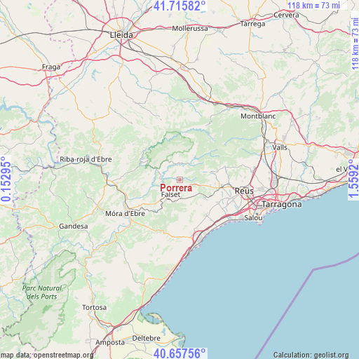
Porrera GPS coordinates[2]
41° 11' 19.788" North, 0° 51' 21.888" East
| Map corner | latitude | longitude |
|---|---|---|
| Upper-left | 41.71582°, | 0.15295° |
| Center: | 41.18883°, | 0.85608° |
| Lower-right: | 40.65756°, | 1.5592° |
| Map W x H: | 117.7×117.7 km | = 73.1×73.1mi |
| max Lat: | 43.74134° ⇑47.1% North |
| Porrera: | 41.18883° |
| min Lat: | ⇓52.9% South 27.64134° |
| min Long | Porrera | max Long |
| -18.00367° | 0.85608° | 4.2899° |
| W 90%⇐ | ⇒10% E |
Elevation
Elevation of Porrera is 324 m = 1063 ft, and this is 274 m = 899 ft below average elevation for this country.
| Max E: |
1682 m = 5518 ft | 73.5% |
| Avg. | 598 m = 1962 ft | |
| Porrera | 324 m = 1063 ft | |
Min E: |
0 m = 0 ft | 26.5% |
See also: Spain elevation on elevation.city.
Geographical zone
Porrera is located in North temperate zone (between Tropic of Cancer and the Arctic Circle). Distance of this Northern Tropic circle is 1973.8 km =1226.5 mi to South.| Distance of | km | miles | from Porrera |
|---|---|---|---|
| North Pole | 5427.3 | 3372.4 | to North |
| Arctic Circle | 2821.4 | 1753.1 | to North |
| Tropic Cancer | 1973.8 | 1226.5 | to South |
| Equator | 4579.8 | 2845.8 | to South |


Nearby cities:
15 places around Porrera: (largest is in red/bold)
• Alforja
10.3 km =6.4 mi,  76°
76°
• Botarell
12.6 km =7.8 mi,  117°
117°
• Colldejou
10.2 km =6.3 mi,  165°
165°
• Cornudella de Montsant
9.5 km =5.9 mi,  25°
25°
• Duesaigües
7.8 km =4.8 mi, 123°
• Falset
5.7 km =3.5 mi,  212°
212°
• Margalef
13.7 km =8.5 mi,  321°
321°
• Mont-roig del Camp
14.3 km =8.9 mi,  142°
142°
• Riudecanyes
11.1 km =6.9 mi, 123°
• Riudecols
10.3 km =6.4 mi,  102°
102°
• Ulldemolins
14.9 km =9.3 mi,  6°
6°
• Vilanova d'Escornalbou
10.3 km =6.4 mi, 141°
• el Masroig
12 km =7.5 mi,  239°
239°
• la Morera de Montsant
8.6 km =5.3 mi,  351°
351°
• les Borges del Camp
13.7 km =8.5 mi, 100°
Sources, notices
• [Note1] Compared only with cities in Spain existing in our database
• [Src1] Map data: © OpenStreetMap contributors (CC-BY-SA)
• [Src2] Other city data from geonames.org with taken over terms of usage.
• [Src3] Geographical zone / Annual Mean Temperature by Robert A. Rohde @ Wikipedia
