Falset geodata
Falset (Catalonia) is a populated place; located in Spain in Europe/Madrid (GMT+2) time zone. With population of 2,662 people, there are 1829 cities with bigger population in this country. Compared to other cities in Spain, 52.1% of cities are located further ↓South; 90% of cities are located further ←West and 70.6% of cities have higher elevation than Falset. Note1


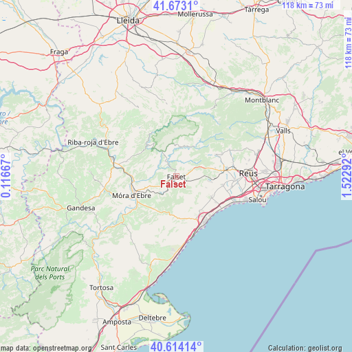
Falset GPS coordinates[2]
41° 8' 44.736" North, 0° 49' 11.244" East
| Map corner | latitude | longitude |
|---|---|---|
| Upper-left | 41.6731°, | 0.11667° |
| Center: | 41.14576°, | 0.81979° |
| Lower-right: | 40.61414°, | 1.52292° |
| Map W x H: | 117.7×117.7 km | = 73.1×73.1mi |
| max Lat: | 43.74134° ⇑47.9% North |
| Falset: | 41.14576° |
| min Lat: | ⇓52.1% South 27.64134° |
| min Long | Falset | max Long |
| -18.00367° | 0.81979° | 4.2899° |
| W 90%⇐ | ⇒10% E |
Elevation
Elevation of Falset is 372 m = 1220 ft, and this is 226 m = 741 ft below average elevation for this country.
| Max E: |
1682 m = 5518 ft | 70.6% |
| Avg. | 598 m = 1962 ft | |
| Falset | 372 m = 1220 ft | |
Min E: |
0 m = 0 ft | 29.4% |
See also: Spain elevation on elevation.city.
Geographical zone
Falset is located in North temperate zone (between Tropic of Cancer and the Arctic Circle). Distance of this Northern Tropic circle is 1969.1 km =1223.5 mi to South.| Distance of | km | miles | from Falset |
|---|---|---|---|
| North Pole | 5432.1 | 3375.3 | to North |
| Arctic Circle | 2826.2 | 1756.1 | to North |
| Tropic Cancer | 1969.1 | 1223.5 | to South |
| Equator | 4575 | 2842.8 | to South |


Nearby cities:
15 places around Falset: (largest is in red/bold)
• Alforja
14.9 km =9.3 mi,  60°
60°
• Botarell
14.2 km =8.8 mi,  94°
94°
• Colldejou
7.6 km =4.7 mi,  132°
132°
• Cornudella de Montsant
15.1 km =9.4 mi,  28°
28°
• Duesaigües
9.5 km =5.9 mi, 87°
• Garcia
14.3 km =8.9 mi,  264°
264°
• Mont-roig del Camp
13.4 km =8.3 mi,  119°
119°
• Porrera
5.7 km =3.5 mi, 32°
• Pratdip
11.3 km =7 mi,  157°
157°
• Riudecanyes
12.4 km =7.7 mi,  96°
96°
• Riudecols
13.4 km =8.3 mi,  78°
78°
• Tivissa
14.4 km =8.9 mi,  210°
210°
• Vilanova d'Escornalbou
10 km =6.2 mi,  108°
108°
• el Masroig
7.4 km =4.6 mi, 259°
• la Morera de Montsant
13.4 km =8.3 mi,  7°
7°
Sources, notices
• [Note1] Compared only with cities in Spain existing in our database
• [Src1] Map data: © OpenStreetMap contributors (CC-BY-SA)
• [Src2] Other city data from geonames.org with taken over terms of usage.
• [Src3] Geographical zone / Annual Mean Temperature by Robert A. Rohde @ Wikipedia
