Peralejos geodata
Peralejos (Aragon) is a seat of a third-order administrative division; located in Spain in Europe/Madrid (GMT+2) time zone. With population of 87 people, there are 6070 cities with bigger population in this country. Compared to other cities in Spain, 62.2% of cities are located further ↑North; 76.9% of cities are located further ←West and 88.9% of cities have lower elevation than Peralejos. Note1


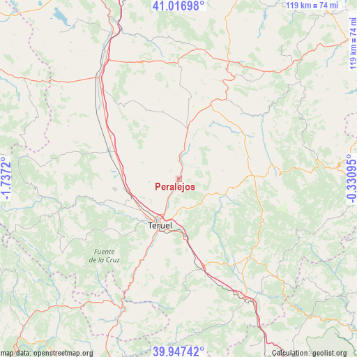
Peralejos GPS coordinates[2]
40° 29' 3.588" North, 1° 2' 2.688" West
| Map corner | latitude | longitude |
|---|---|---|
| Upper-left | 41.01698°, | -1.7372° |
| Center: | 40.48433°, | -1.03408° |
| Lower-right: | 39.94742°, | -0.33095° |
| Map W x H: | 118.9×118.9 km | = 73.9×73.9mi |
| max Lat: | 43.74134° ⇑62.2% North |
| Peralejos: | 40.48433° |
| min Lat: | ⇓37.8% South 27.64134° |
| min Long | Peralejos | max Long |
| -18.00367° | -1.03408° | 4.2899° |
| W 76.9%⇐ | ⇒23.1% E |
Elevation
Elevation of Peralejos is 1012 m = 3320 ft, and this is 414 m = 1358 ft above average elevation for this country.
| Max E: |
1682 m = 5518 ft | 11.1% |
| Peralejos | 1012 m 3320 ft | |
| Avg. | 598 m = 1962 ft | |
Min E: |
0 m = 0 ft | 88.9% |
See also: Spain elevation on elevation.city.
Geographical zone
Peralejos is located in North temperate zone (between Tropic of Cancer and the Arctic Circle). Distance of this Northern Tropic circle is 1895.5 km =1177.8 mi to South.| Distance of | km | miles | from Peralejos |
|---|---|---|---|
| North Pole | 5505.6 | 3421 | to North |
| Arctic Circle | 2899.7 | 1801.8 | to North |
| Tropic Cancer | 1895.5 | 1177.8 | to South |
| Equator | 4501.4 | 2797 | to South |


Nearby cities:
15 places around Peralejos: (largest is in red/bold)
• Ababuj
20.5 km =12.7 mi,  69°
69°
• Alfambra
6.9 km =4.3 mi,  0°
0°
• Camañas
19.7 km =12.2 mi,  333°
333°
• Cedrillas
16.3 km =10.1 mi,  108°
108°
• Cella
21.7 km =13.5 mi,  260°
260°
• Corbalán
9.9 km =6.2 mi,  155°
155°
• Cuevas Labradas
3.7 km =2.3 mi,  201°
201°
• El Castellar
22.6 km =14 mi,  125°
125°
• Escorihuela
8.5 km =5.3 mi,  38°
38°
• Formiche Alto
21.5 km =13.4 mi,  146°
146°
• Monteagudo del Castillo
18.6 km =11.6 mi,  99°
99°
• Orrios
12.4 km =7.7 mi,  19°
19°
• Perales del Alfambra
16.8 km =10.4 mi,  9°
9°
• Teruel
16.6 km =10.3 mi, 201°
• Villarquemado
19.9 km =12.4 mi,  280°
280°
Sources, notices
• [Note1] Compared only with cities in Spain existing in our database
• [Src1] Map data: © OpenStreetMap contributors (CC-BY-SA)
• [Src2] Other city data from geonames.org with taken over terms of usage.
• [Src3] Geographical zone / Annual Mean Temperature by Robert A. Rohde @ Wikipedia
