Peñalén geodata
Peñalén (Castille-La Mancha) is a seat of a third-order administrative division; located in Spain in Europe/Madrid (GMT+2) time zone. With population of 125 people, there are 5639 cities with bigger population in this country. Compared to other cities in Spain, 58.6% of cities are located further ↑North; 66.6% of cities are located further ←West and 99.1% of cities have lower elevation than Peñalén. Note1
Administrative division(s):
- Level 1: Castille-La Mancha
- Level 2: Provincia de Guadalajara
- Level 3: Peñalén


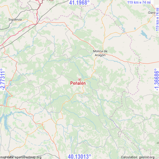
Peñalén GPS coordinates[2]
40° 39' 56.16" North, 2° 4' 11.964" West
| Map corner | latitude | longitude |
|---|---|---|
| Upper-left | 41.1968°, | -2.77311° |
| Center: | 40.6656°, | -2.06999° |
| Lower-right: | 40.13013°, | -1.36686° |
| Map W x H: | 118.6×118.6 km | = 73.7×73.7mi |
| max Lat: | 43.74134° ⇑58.6% North |
| Peñalén: | 40.6656° |
| min Lat: | ⇓41.4% South 27.64134° |
| min Long | Peñalén | max Long |
| -18.00367° | -2.06999° | 4.2899° |
| W 66.6%⇐ | ⇒33.4% E |
Elevation
Elevation of Peñalén is 1356 m = 4449 ft, and this is 758 m = 2487 ft above average elevation for this country.
| Max E: |
1682 m = 5518 ft | 0.90000000000001% |
| Peñalén | 1356 m 4449 ft | |
| Avg. | 598 m = 1962 ft | |
Min E: |
0 m = 0 ft | 99.1% |
See also: Spain elevation on elevation.city.
Geographical zone
Peñalén is located in North temperate zone (between Tropic of Cancer and the Arctic Circle). Distance of this Northern Tropic circle is 1915.7 km =1190.4 mi to South.| Distance of | km | miles | from Peñalén |
|---|---|---|---|
| North Pole | 5485.5 | 3408.5 | to North |
| Arctic Circle | 2879.6 | 1789.3 | to North |
| Tropic Cancer | 1915.7 | 1190.4 | to South |
| Equator | 4521.6 | 2809.6 | to South |


Nearby cities:
15 places around Peñalén: (largest is in red/bold)
• Baños de Tajo
10.4 km =6.5 mi,  56°
56°
• Beteta
10.4 km =6.5 mi,  182°
182°
• Carrascosa
11.4 km =7.1 mi,  223°
223°
• Cueva del Hierro
9.7 km =6 mi,  162°
162°
• Fuembellida
11.7 km =7.3 mi,  30°
30°
• Lagunaseca
15.6 km =9.7 mi, 164°
• Masegosa
13.7 km =8.5 mi, 164°
• Peralejos de las Truchas
15.7 km =9.8 mi,  120°
120°
• Poveda de la Sierra
4.3 km =2.7 mi,  125°
125°
• Taravilla
9.3 km =5.8 mi,  67°
67°
• Terzaga
14.4 km =8.9 mi,  76°
76°
• Tierzo
15 km =9.3 mi,  51°
51°
• Valsalobre
5.7 km =3.5 mi,  199°
199°
• Villanueva de Alcorón
15.4 km =9.6 mi,  275°
275°
• Zaorejas
15.4 km =9.6 mi,  314°
314°
Sources, notices
• [Note1] Compared only with cities in Spain existing in our database
• [Src1] Map data: © OpenStreetMap contributors (CC-BY-SA)
• [Src2] Other city data from geonames.org with taken over terms of usage.
• [Src3] Geographical zone / Annual Mean Temperature by Robert A. Rohde @ Wikipedia
