Carrascosa geodata
Carrascosa (Castille-La Mancha) is a seat of a third-order administrative division; located in Spain in Europe/Madrid (GMT+2) time zone. With population of 113 people, there are 5780 cities with bigger population in this country. Compared to other cities in Spain, 60% of cities are located further ↑North; 65.3% of cities are located further ←West and 98.1% of cities have lower elevation than Carrascosa. Note1
Administrative division(s):
- Level 1: Castille-La Mancha
- Level 2: Provincia de Cuenca
- Level 3: Carrascosa


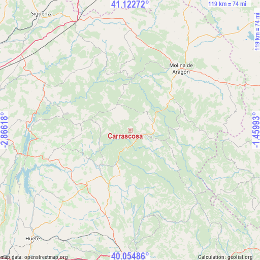
Carrascosa GPS coordinates[2]
40° 35' 27.312" North, 2° 9' 46.98" West
| Map corner | latitude | longitude |
|---|---|---|
| Upper-left | 41.12272°, | -2.86618° |
| Center: | 40.59092°, | -2.16305° |
| Lower-right: | 40.05486°, | -1.45993° |
| Map W x H: | 118.7×118.7 km | = 73.8×73.8mi |
| max Lat: | 43.74134° ⇑60% North |
| Carrascosa: | 40.59092° |
| min Lat: | ⇓40% South 27.64134° |
| min Long | Carrascosa | max Long |
| -18.00367° | -2.16305° | 4.2899° |
| W 65.3%⇐ | ⇒34.7% E |
Elevation
Elevation of Carrascosa is 1259 m = 4131 ft, and this is 661 m = 2169 ft above average elevation for this country.
| Max E: |
1682 m = 5518 ft | 1.9% |
| Carrascosa | 1259 m 4131 ft | |
| Avg. | 598 m = 1962 ft | |
Min E: |
0 m = 0 ft | 98.1% |
See also: Spain elevation on elevation.city.
Geographical zone
Carrascosa is located in North temperate zone (between Tropic of Cancer and the Arctic Circle). Distance of this Northern Tropic circle is 1907.4 km =1185.2 mi to South.| Distance of | km | miles | from Carrascosa |
|---|---|---|---|
| North Pole | 5493.8 | 3413.7 | to North |
| Arctic Circle | 2887.9 | 1794.5 | to North |
| Tropic Cancer | 1907.4 | 1185.2 | to South |
| Equator | 4513.3 | 2804.4 | to South |


Nearby cities:
15 places around Carrascosa: (largest is in red/bold)
• Alcantud
15.1 km =9.4 mi,  251°
251°
• Beteta
7.7 km =4.8 mi,  106°
106°
• Cañamares
16.8 km =10.4 mi,  202°
202°
• Cañizares
8.4 km =5.2 mi, 196°
• Cueva del Hierro
10.8 km =6.7 mi,  94°
94°
• Fuertescusa
12.9 km =8 mi,  184°
184°
• Lagunaseca
13.8 km =8.6 mi,  118°
118°
• Masegosa
12.6 km =7.8 mi, 112°
• Peñalén
11.4 km =7.1 mi,  43°
43°
• Poveda de la Sierra
12.7 km =7.9 mi,  62°
62°
• Santa María del Val
14.1 km =8.8 mi,  133°
133°
• Valsalobre
6.6 km =4.1 mi, 63°
• Villanueva de Alcorón
12.4 km =7.7 mi,  322°
322°
• Vindel
18.4 km =11.4 mi,  268°
268°
• Zaorejas
19.3 km =12 mi,  350°
350°
Sources, notices
• [Note1] Compared only with cities in Spain existing in our database
• [Src1] Map data: © OpenStreetMap contributors (CC-BY-SA)
• [Src2] Other city data from geonames.org with taken over terms of usage.
• [Src3] Geographical zone / Annual Mean Temperature by Robert A. Rohde @ Wikipedia
