Valsalobre geodata
Valsalobre (Castille-La Mancha) is a seat of a third-order administrative division; located in Spain in Europe/Madrid (GMT+2) time zone. With population of 65 people, there are 6290 cities with bigger population in this country. Compared to other cities in Spain, 59.5% of cities are located further ↑North; 66.3% of cities are located further ←West and 97.5% of cities have lower elevation than Valsalobre. Note1
Administrative division(s):
- Level 1: Castille-La Mancha
- Level 2: Provincia de Cuenca
- Level 3: Valsalobre


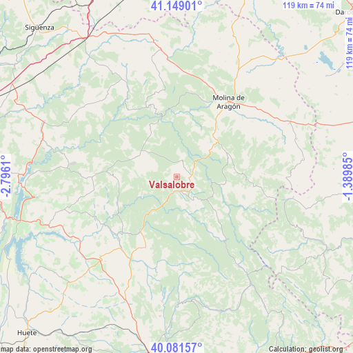
Valsalobre GPS coordinates[2]
40° 37' 2.712" North, 2° 5' 34.692" West
| Map corner | latitude | longitude |
|---|---|---|
| Upper-left | 41.14901°, | -2.7961° |
| Center: | 40.61742°, | -2.09297° |
| Lower-right: | 40.08157°, | -1.38985° |
| Map W x H: | 118.7×118.7 km | = 73.8×73.8mi |
| max Lat: | 43.74134° ⇑59.5% North |
| Valsalobre: | 40.61742° |
| min Lat: | ⇓40.5% South 27.64134° |
| min Long | Valsalobre | max Long |
| -18.00367° | -2.09297° | 4.2899° |
| W 66.3%⇐ | ⇒33.7% E |
Elevation
Elevation of Valsalobre is 1225 m = 4019 ft, and this is 627 m = 2057 ft above average elevation for this country.
| Max E: |
1682 m = 5518 ft | 2.5% |
| Valsalobre | 1225 m 4019 ft | |
| Avg. | 598 m = 1962 ft | |
Min E: |
0 m = 0 ft | 97.5% |
See also: Spain elevation on elevation.city.
Geographical zone
Valsalobre is located in North temperate zone (between Tropic of Cancer and the Arctic Circle). Distance of this Northern Tropic circle is 1910.3 km =1187 mi to South.| Distance of | km | miles | from Valsalobre |
|---|---|---|---|
| North Pole | 5490.8 | 3411.8 | to North |
| Arctic Circle | 2884.9 | 1792.6 | to North |
| Tropic Cancer | 1910.3 | 1187 | to South |
| Equator | 4516.2 | 2806.2 | to South |


Nearby cities:
15 places around Valsalobre: (largest is in red/bold)
• Baños de Tajo
15.3 km =9.5 mi,  43°
43°
• Beteta
5.3 km =3.3 mi,  164°
164°
• Carrascosa
6.6 km =4.1 mi,  243°
243°
• Cañizares
13.8 km =8.6 mi,  217°
217°
• Cueva del Hierro
6.2 km =3.9 mi,  128°
128°
• Fuembellida
17.3 km =10.7 mi,  27°
27°
• Fuertescusa
17.3 km =10.7 mi,  204°
204°
• Lagunaseca
11.4 km =7.1 mi,  147°
147°
• Masegosa
9.7 km =6 mi,  144°
144°
• Peralejos de las Truchas
15.7 km =9.8 mi,  99°
99°
• Peñalén
5.7 km =3.5 mi,  19°
19°
• Poveda de la Sierra
6.1 km =3.8 mi,  61°
61°
• Santa María del Val
13.3 km =8.3 mi, 160°
• Taravilla
13.8 km =8.6 mi,  49°
49°
• Villanueva de Alcorón
15 km =9.3 mi,  297°
297°
Sources, notices
• [Note1] Compared only with cities in Spain existing in our database
• [Src1] Map data: © OpenStreetMap contributors (CC-BY-SA)
• [Src2] Other city data from geonames.org with taken over terms of usage.
• [Src3] Geographical zone / Annual Mean Temperature by Robert A. Rohde @ Wikipedia
