Terzaga geodata
Terzaga (Castille-La Mancha) is a seat of a third-order administrative division; located in Spain in Europe/Madrid (GMT+2) time zone. With population of 27 people, there are 6683 cities with bigger population in this country. Compared to other cities in Spain, 58.1% of cities are located further ↑North; 68.4% of cities are located further ←West and 96.3% of cities have lower elevation than Terzaga. Note1
Administrative division(s):
- Level 1: Castille-La Mancha
- Level 2: Provincia de Guadalajara
- Level 3: Terzaga


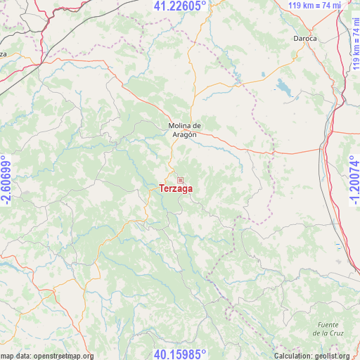
Terzaga GPS coordinates[2]
40° 41' 42.288" North, 1° 54' 13.896" West
| Map corner | latitude | longitude |
|---|---|---|
| Upper-left | 41.22605°, | -2.60699° |
| Center: | 40.69508°, | -1.90386° |
| Lower-right: | 40.15985°, | -1.20074° |
| Map W x H: | 118.6×118.5 km | = 73.7×73.6mi |
| max Lat: | 43.74134° ⇑58.1% North |
| Terzaga: | 40.69508° |
| min Lat: | ⇓41.9% South 27.64134° |
| min Long | Terzaga | max Long |
| -18.00367° | -1.90386° | 4.2899° |
| W 68.4%⇐ | ⇒31.6% E |
Elevation
Elevation of Terzaga is 1183 m = 3881 ft, and this is 585 m = 1919 ft above average elevation for this country.
| Max E: |
1682 m = 5518 ft | 3.7% |
| Terzaga | 1183 m 3881 ft | |
| Avg. | 598 m = 1962 ft | |
Min E: |
0 m = 0 ft | 96.3% |
See also: Spain elevation on elevation.city.
Geographical zone
Terzaga is located in North temperate zone (between Tropic of Cancer and the Arctic Circle). Distance of this Northern Tropic circle is 1918.9 km =1192.3 mi to South.| Distance of | km | miles | from Terzaga |
|---|---|---|---|
| North Pole | 5482.2 | 3406.5 | to North |
| Arctic Circle | 2876.3 | 1787.2 | to North |
| Tropic Cancer | 1918.9 | 1192.3 | to South |
| Equator | 4524.9 | 2811.6 | to South |


Nearby cities:
15 places around Terzaga: (largest is in red/bold)
• Baños de Tajo
5.8 km =3.6 mi,  294°
294°
• Castilnuevo
13.8 km =8.6 mi,  16°
16°
• Chequilla
11.8 km =7.3 mi,  147°
147°
• Fuembellida
10.5 km =6.5 mi,  310°
310°
• Megina
6.8 km =4.2 mi,  155°
155°
• Peralejos de las Truchas
11.3 km =7 mi,  182°
182°
• Peñalén
14.4 km =8.9 mi,  256°
256°
• Pinilla de Molina
2.6 km =1.6 mi,  130°
130°
• Poveda de la Sierra
12 km =7.5 mi,  241°
241°
• Prados Redondos
13.7 km =8.5 mi,  42°
42°
• Taravilla
5.4 km =3.4 mi,  272°
272°
• Tierzo
6.4 km =4 mi,  339°
339°
• Torrecuadrada de Molina
10.2 km =6.3 mi,  53°
53°
• Torremochuela
9.4 km =5.8 mi,  33°
33°
• Valhermoso
11.2 km =7 mi,  334°
334°
Sources, notices
• [Note1] Compared only with cities in Spain existing in our database
• [Src1] Map data: © OpenStreetMap contributors (CC-BY-SA)
• [Src2] Other city data from geonames.org with taken over terms of usage.
• [Src3] Geographical zone / Annual Mean Temperature by Robert A. Rohde @ Wikipedia
