Fuembellida geodata
Fuembellida (Castille-La Mancha) is a seat of a third-order administrative division; located in Spain in Europe/Madrid (GMT+2) time zone. With population of 14 people, there are 6750 cities with bigger population in this country. Compared to other cities in Spain, 57% of cities are located further ↑North; 67.6% of cities are located further ←West and 97.4% of cities have lower elevation than Fuembellida. Note1
Administrative division(s):
- Level 1: Castille-La Mancha
- Level 2: Provincia de Guadalajara
- Level 3: Fuembellida


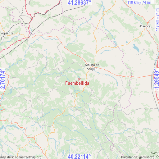
Fuembellida GPS coordinates[2]
40° 45' 21.204" North, 1° 59' 54.996" West
| Map corner | latitude | longitude |
|---|---|---|
| Upper-left | 41.28637°, | -2.70174° |
| Center: | 40.75589°, | -1.99861° |
| Lower-right: | 40.22114°, | -1.29549° |
| Map W x H: | 118.4×118.4 km | = 73.6×73.6mi |
| max Lat: | 43.74134° ⇑57% North |
| Fuembellida: | 40.75589° |
| min Lat: | ⇓43% South 27.64134° |
| min Long | Fuembellida | max Long |
| -18.00367° | -1.99861° | 4.2899° |
| W 67.6%⇐ | ⇒32.4% E |
Elevation
Elevation of Fuembellida is 1222 m = 4009 ft, and this is 624 m = 2047 ft above average elevation for this country.
| Max E: |
1682 m = 5518 ft | 2.6% |
| Fuembellida | 1222 m 4009 ft | |
| Avg. | 598 m = 1962 ft | |
Min E: |
0 m = 0 ft | 97.4% |
See also: Spain elevation on elevation.city.
Geographical zone
Fuembellida is located in North temperate zone (between Tropic of Cancer and the Arctic Circle). Distance of this Northern Tropic circle is 1925.7 km =1196.6 mi to South.| Distance of | km | miles | from Fuembellida |
|---|---|---|---|
| North Pole | 5475.4 | 3402.3 | to North |
| Arctic Circle | 2869.5 | 1783 | to North |
| Tropic Cancer | 1925.7 | 1196.6 | to South |
| Equator | 4531.6 | 2815.8 | to South |


Nearby cities:
15 places around Fuembellida: (largest is in red/bold)
• Baños de Tajo
5.1 km =3.2 mi,  148°
148°
• Castilnuevo
13.5 km =8.4 mi,  61°
61°
• Corduente
9.8 km =6.1 mi,  9°
9°
• Herrería
15.1 km =9.4 mi, 12°
• Molina de Aragón
13.5 km =8.4 mi,  43°
43°
• Peñalén
11.7 km =7.3 mi,  210°
210°
• Pinilla de Molina
13.1 km =8.1 mi,  130°
130°
• Poveda de la Sierra
12.8 km =8 mi,  191°
191°
• Rillo de Gallo
13.3 km =8.3 mi,  22°
22°
• Taravilla
7 km =4.3 mi,  158°
158°
• Terzaga
10.5 km =6.5 mi, 130°
• Tierzo
5.8 km =3.6 mi,  97°
97°
• Torremocha del Pinar
15.4 km =9.6 mi,  345°
345°
• Torremochuela
13.2 km =8.2 mi,  85°
85°
• Valhermoso
4.6 km =2.9 mi, 43°
Sources, notices
• [Note1] Compared only with cities in Spain existing in our database
• [Src1] Map data: © OpenStreetMap contributors (CC-BY-SA)
• [Src2] Other city data from geonames.org with taken over terms of usage.
• [Src3] Geographical zone / Annual Mean Temperature by Robert A. Rohde @ Wikipedia
