Hormigos geodata
Hormigos (Castille-La Mancha) is a seat of a third-order administrative division; located in Spain in Europe/Madrid (GMT+2) time zone. With population of 492 people, there are 3909 cities with bigger population in this country. Compared to other cities in Spain, 68.9% of cities are located further ↑North; 65.5% of cities are located further →East and 64.8% of cities have higher elevation than Hormigos. Note1
Administrative division(s):
- Level 1: Castille-La Mancha
- Level 2: Province of Toledo
- Level 3: Hormigos


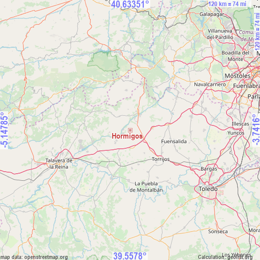
Hormigos GPS coordinates[2]
40° 5' 52.008" North, 4° 26' 41.028" West
| Map corner | latitude | longitude |
|---|---|---|
| Upper-left | 40.63351°, | -5.14785° |
| Center: | 40.09778°, | -4.44473° |
| Lower-right: | 39.5578°, | -3.7416° |
| Map W x H: | 119.6×119.6 km | = 74.3×74.3mi |
| max Lat: | 43.74134° ⇑68.9% North |
| Hormigos: | 40.09778° |
| min Lat: | ⇓31.1% South 27.64134° |
| min Long | Hormigos | max Long |
| -18.00367° | -4.44473° | 4.2899° |
| W 34.5%⇐ | ⇒65.5% E |
Elevation
Elevation of Hormigos is 463 m = 1519 ft, and this is 135 m = 443 ft below average elevation for this country.
| Max E: |
1682 m = 5518 ft | 64.8% |
| Avg. | 598 m = 1962 ft | |
| Hormigos | 463 m = 1519 ft | |
Min E: |
0 m = 0 ft | 35.2% |
See also: Spain elevation on elevation.city.
Geographical zone
Hormigos is located in North temperate zone (between Tropic of Cancer and the Arctic Circle). Distance of this Northern Tropic circle is 1852.5 km =1151.1 mi to South.| Distance of | km | miles | from Hormigos |
|---|---|---|---|
| North Pole | 5548.6 | 3447.7 | to North |
| Arctic Circle | 2942.7 | 1828.5 | to North |
| Tropic Cancer | 1852.5 | 1151.1 | to South |
| Equator | 4458.5 | 2770.4 | to South |


Nearby cities:
15 places around Hormigos: (largest is in red/bold)
• Alcabón
12.4 km =7.7 mi,  148°
148°
• Almorox
15.9 km =9.9 mi,  16°
16°
• Carriches
14.9 km =9.3 mi,  184°
184°
• Domingo Pérez
14.4 km =8.9 mi,  201°
201°
• El Casar de Escalona
8.9 km =5.5 mi,  230°
230°
• Escalona
8.4 km =5.2 mi, 23°
• Maqueda
7.2 km =4.5 mi,  119°
119°
• Nombela
8 km =5 mi,  322°
322°
• Novés
15.5 km =9.6 mi,  111°
111°
• Nuño Gómez
15 km =9.3 mi,  276°
276°
• Otero
12.3 km =7.6 mi,  209°
209°
• Paredes de Escalona
12 km =7.5 mi,  5°
5°
• Pelahustán
15.7 km =9.8 mi,  303°
303°
• Quismondo
10.3 km =6.4 mi,  85°
85°
• Santa Olalla
8.4 km =5.2 mi,  171°
171°
Sources, notices
• [Note1] Compared only with cities in Spain existing in our database
• [Src1] Map data: © OpenStreetMap contributors (CC-BY-SA)
• [Src2] Other city data from geonames.org with taken over terms of usage.
• [Src3] Geographical zone / Annual Mean Temperature by Robert A. Rohde @ Wikipedia
