Pedrosa del Páramo geodata
Pedrosa del Páramo (Castille and León) is a seat of a third-order administrative division; located in Spain in Europe/Madrid (GMT+2) time zone. With population of 99 people, there are 5951 cities with bigger population in this country. Compared to other cities in Spain, 86% of cities are located further ↓South; 59.3% of cities are located further →East and 84.1% of cities have lower elevation than Pedrosa del Páramo. Note1
Administrative division(s):
- Level 1: Castille and León
- Level 2: Provincia de Burgos
- Level 3: Pedrosa del Páramo


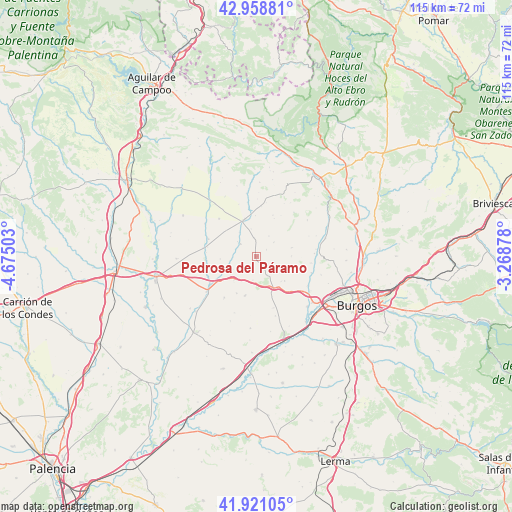
Pedrosa del Páramo GPS coordinates[2]
42° 26' 31.488" North, 3° 58' 18.84" West
| Map corner | latitude | longitude |
|---|---|---|
| Upper-left | 42.95881°, | -4.67503° |
| Center: | 42.44208°, | -3.9719° |
| Lower-right: | 41.92105°, | -3.26878° |
| Map W x H: | 115.4×115.4 km | = 71.7×71.7mi |
| max Lat: | 43.74134° ⇑14% North |
| Pedrosa del Páramo: | 42.44208° |
| min Lat: | ⇓86% South 27.64134° |
| min Long | Pedrosa del Pá | max Long |
| -18.00367° | -3.9719° | 4.2899° |
| W 40.7%⇐ | ⇒59.3% E |
Elevation
Elevation of Pedrosa del Páramo is 941 m = 3087 ft, and this is 343 m = 1125 ft above average elevation for this country.
| Max E: |
1682 m = 5518 ft | 15.9% |
| Pedrosa del Páramo | 941 m 3087 ft | |
| Avg. | 598 m = 1962 ft | |
Min E: |
0 m = 0 ft | 84.1% |
See also: Spain elevation on elevation.city.
Geographical zone
Pedrosa del Páramo is located in North temperate zone (between Tropic of Cancer and the Arctic Circle). Distance of this Northern Tropic circle is 2113.2 km =1313.1 mi to South.| Distance of | km | miles | from Pedrosa del Páramo |
|---|---|---|---|
| North Pole | 5287.9 | 3285.7 | to North |
| Arctic Circle | 2682.1 | 1666.6 | to North |
| Tropic Cancer | 2113.2 | 1313.1 | to South |
| Equator | 4719.1 | 2932.3 | to South |


Nearby cities:
15 places around Pedrosa del Páramo: (largest is in red/bold)
• Castellanos de Castro
13.7 km =8.5 mi,  201°
201°
• Grijalba
12.1 km =7.5 mi,  263°
263°
• Hontanas
15.6 km =9.7 mi, 202°
• Hornillos del Camino
12.1 km =7.5 mi,  161°
161°
• Isar
9.6 km =6 mi, 159°
• Manciles
2.8 km =1.7 mi,  52°
52°
• Sasamón
6.5 km =4 mi,  244°
244°
• Sordillos
11.3 km =7 mi,  281°
281°
• Susinos del Páramo
5 km =3.1 mi, 49°
• Tobar
5.3 km =3.3 mi,  29°
29°
• Villadiego
8.8 km =5.5 mi,  339°
339°
• Villamayor de Treviño
12.3 km =7.6 mi, 279°
• Villanueva de Argaño
7.5 km =4.7 mi, 155°
• Villasandino
13.8 km =8.6 mi,  234°
234°
• Villegas
4.8 km =3 mi,  308°
308°
Sources, notices
• [Note1] Compared only with cities in Spain existing in our database
• [Src1] Map data: © OpenStreetMap contributors (CC-BY-SA)
• [Src2] Other city data from geonames.org with taken over terms of usage.
• [Src3] Geographical zone / Annual Mean Temperature by Robert A. Rohde @ Wikipedia
