Manciles geodata
Manciles (Castille and León) is a seat of a third-order administrative division; located in Spain in Europe/Madrid (GMT+2) time zone. With population of 32 people, there are 6640 cities with bigger population in this country. Compared to other cities in Spain, 86.3% of cities are located further ↓South; 59% of cities are located further →East and 79.7% of cities have lower elevation than Manciles. Note1
Administrative division(s):
- Level 1: Castille and León
- Level 2: Provincia de Burgos
- Level 3: Manciles


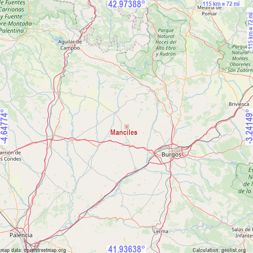
Manciles GPS coordinates[2]
42° 27' 26.208" North, 3° 56' 40.596" West
| Map corner | latitude | longitude |
|---|---|---|
| Upper-left | 42.97388°, | -4.64774° |
| Center: | 42.45728°, | -3.94461° |
| Lower-right: | 41.93638°, | -3.24149° |
| Map W x H: | 115.4×115.4 km | = 71.7×71.7mi |
| max Lat: | 43.74134° ⇑13.7% North |
| Manciles: | 42.45728° |
| min Lat: | ⇓86.3% South 27.64134° |
| min Long | Manciles | max Long |
| -18.00367° | -3.94461° | 4.2899° |
| W 41%⇐ | ⇒59% E |
Elevation
Elevation of Manciles is 894 m = 2933 ft, and this is 296 m = 971 ft above average elevation for this country.
| Max E: |
1682 m = 5518 ft | 20.3% |
| Manciles | 894 m 2933 ft | |
| Avg. | 598 m = 1962 ft | |
Min E: |
0 m = 0 ft | 79.7% |
See also: Spain elevation on elevation.city.
Geographical zone
Manciles is located in North temperate zone (between Tropic of Cancer and the Arctic Circle). Distance of this Northern Tropic circle is 2114.9 km =1314.1 mi to South.| Distance of | km | miles | from Manciles |
|---|---|---|---|
| North Pole | 5286.3 | 3284.8 | to North |
| Arctic Circle | 2680.4 | 1665.5 | to North |
| Tropic Cancer | 2114.9 | 1314.1 | to South |
| Equator | 4720.8 | 2933.4 | to South |


Nearby cities:
15 places around Manciles: (largest is in red/bold)
• Grijalba
14.6 km =9.1 mi,  258°
258°
• Hornillos del Camino
13.3 km =8.3 mi,  173°
173°
• Huérmeces
16 km =9.9 mi,  63°
63°
• Isar
10.7 km =6.6 mi, 173°
• Pedrosa del Páramo
2.8 km =1.7 mi,  232°
232°
• Rabé de las Calzadas
15.8 km =9.8 mi,  145°
145°
• Santibáñez-Zarzaguda
13.5 km =8.4 mi,  79°
79°
• Sasamón
9.2 km =5.7 mi,  240°
240°
• Sordillos
13.4 km =8.3 mi,  272°
272°
• Susinos del Páramo
2.2 km =1.4 mi,  45°
45°
• Tobar
3 km =1.9 mi,  7°
7°
• Villadiego
8.4 km =5.2 mi,  320°
320°
• Villamayor de Treviño
14.3 km =8.9 mi, 271°
• Villanueva de Argaño
8.6 km =5.3 mi, 173°
• Villegas
6.1 km =3.8 mi,  281°
281°
Sources, notices
• [Note1] Compared only with cities in Spain existing in our database
• [Src1] Map data: © OpenStreetMap contributors (CC-BY-SA)
• [Src2] Other city data from geonames.org with taken over terms of usage.
• [Src3] Geographical zone / Annual Mean Temperature by Robert A. Rohde @ Wikipedia
