Ortigosa del Monte geodata
Ortigosa del Monte (Castille and León) is a seat of a third-order administrative division; located in Spain in Europe/Madrid (GMT+2) time zone. With population of 457 people, there are 3992 cities with bigger population in this country. Compared to other cities in Spain, 55.1% of cities are located further ↑North; 62.3% of cities are located further →East and 93.5% of cities have lower elevation than Ortigosa del Monte. Note1
Administrative division(s):
- Level 1: Castille and León
- Level 2: Provincia de Segovia
- Level 3: Ortigosa del Monte


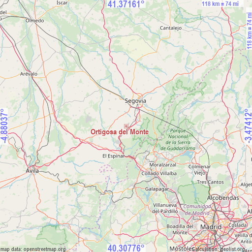
Ortigosa del Monte GPS coordinates[2]
40° 50' 30.552" North, 4° 10' 38.064" West
| Map corner | latitude | longitude |
|---|---|---|
| Upper-left | 41.37161°, | -4.88037° |
| Center: | 40.84182°, | -4.17724° |
| Lower-right: | 40.30776°, | -3.47412° |
| Map W x H: | 118.3×118.3 km | = 73.5×73.5mi |
| max Lat: | 43.74134° ⇑55.1% North |
| Ortigosa del Monte: | 40.84182° |
| min Lat: | ⇓44.9% South 27.64134° |
| min Long | Ortigosa del Mo | max Long |
| -18.00367° | -4.17724° | 4.2899° |
| W 37.7%⇐ | ⇒62.3% E |
Elevation
Elevation of Ortigosa del Monte is 1104 m = 3622 ft, and this is 506 m = 1660 ft above average elevation for this country.
| Max E: |
1682 m = 5518 ft | 6.5% |
| Ortigosa del Monte | 1104 m 3622 ft | |
| Avg. | 598 m = 1962 ft | |
Min E: |
0 m = 0 ft | 93.5% |
See also: Spain elevation on elevation.city.
Geographical zone
Ortigosa del Monte is located in North temperate zone (between Tropic of Cancer and the Arctic Circle). Distance of this Northern Tropic circle is 1935.3 km =1202.5 mi to South.| Distance of | km | miles | from Ortigosa del Monte |
|---|---|---|---|
| North Pole | 5465.9 | 3396.4 | to North |
| Arctic Circle | 2860 | 1777.1 | to North |
| Tropic Cancer | 1935.3 | 1202.5 | to South |
| Equator | 4541.2 | 2821.8 | to South |


Nearby cities:
15 places around Ortigosa del Monte: (largest is in red/bold)
• Abades
11.4 km =7.1 mi,  316°
316°
• Cercedilla
15.1 km =9.4 mi,  137°
137°
• La Lastrilla
15.3 km =9.5 mi,  23°
23°
• Lastras del Pozo
14.8 km =9.2 mi,  286°
286°
• Los Ángeles de San Rafael
7.8 km =4.8 mi,  203°
203°
• Martín Miguel
14.6 km =9.1 mi,  327°
327°
• Monterrubio
14.6 km =9.1 mi,  273°
273°
• Otero de Herreros
3.7 km =2.3 mi,  228°
228°
• Palazuelos de Eresma
13.9 km =8.6 mi,  44°
44°
• San Cristóbal de Segovia
14.9 km =9.3 mi,  34°
34°
• Segovia
12.8 km =8 mi, 22°
• Valdeprados
7.3 km =4.5 mi,  248°
248°
• Valverde del Majano
13.7 km =8.5 mi,  339°
339°
• Vegas de Matute
9.9 km =6.2 mi,  238°
238°
• Zarzuela del Monte
13.9 km =8.6 mi, 254°
Sources, notices
• [Note1] Compared only with cities in Spain existing in our database
• [Src1] Map data: © OpenStreetMap contributors (CC-BY-SA)
• [Src2] Other city data from geonames.org with taken over terms of usage.
• [Src3] Geographical zone / Annual Mean Temperature by Robert A. Rohde @ Wikipedia
