Olvega geodata
Olvega (Castille and León) is a populated place; located in Spain in Europe/Madrid (GMT+2) time zone. With population of 3,346 people, there are 1625 cities with bigger population in this country. Compared to other cities in Spain, 68% of cities are located further ↓South; 67.7% of cities are located further ←West and 90.5% of cities have lower elevation than Olvega. Note1


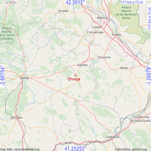
Olvega GPS coordinates[2]
41° 46' 44.436" North, 1° 59' 2.076" West
| Map corner | latitude | longitude |
|---|---|---|
| Upper-left | 42.3012°, | -2.68704° |
| Center: | 41.77901°, | -1.98391° |
| Lower-right: | 41.25253°, | -1.28079° |
| Map W x H: | 116.6×116.6 km | = 72.5×72.5mi |
| max Lat: | 43.74134° ⇑32% North |
| Olvega: | 41.77901° |
| min Lat: | ⇓68% South 27.64134° |
| min Long | Olvega | max Long |
| -18.00367° | -1.98391° | 4.2899° |
| W 67.7%⇐ | ⇒32.3% E |
Elevation
Elevation of Olvega is 1040 m = 3412 ft, and this is 442 m = 1450 ft above average elevation for this country.
| Max E: |
1682 m = 5518 ft | 9.5% |
| Olvega | 1040 m 3412 ft | |
| Avg. | 598 m = 1962 ft | |
Min E: |
0 m = 0 ft | 90.5% |
See also: Spain elevation on elevation.city.
Geographical zone
Olvega is located in North temperate zone (between Tropic of Cancer and the Arctic Circle). Distance of this Northern Tropic circle is 2039.5 km =1267.3 mi to South.| Distance of | km | miles | from Olvega |
|---|---|---|---|
| North Pole | 5361.7 | 3331.6 | to North |
| Arctic Circle | 2755.8 | 1712.4 | to North |
| Tropic Cancer | 2039.5 | 1267.3 | to South |
| Equator | 4645.4 | 2886.5 | to South |


Nearby cities:
15 places around Olvega: (largest is in red/bold)
• Beratón
15.9 km =9.9 mi,  115°
115°
• Borobia
14.6 km =9.1 mi,  150°
150°
• Castilruiz
12.5 km =7.8 mi,  330°
330°
• Cueva de Ágreda
8.1 km =5 mi,  102°
102°
• Fuentestrún
13.4 km =8.3 mi,  322°
322°
• Hinojosa del Campo
10.6 km =6.6 mi,  244°
244°
• Matalebreras
8.6 km =5.3 mi, 323°
• Noviercas
8.6 km =5.3 mi,  209°
209°
• Pinilla del Campo
10.8 km =6.7 mi,  230°
230°
• Pozalmuro
9.8 km =6.1 mi,  267°
267°
• Tajahuerce
14.5 km =9 mi,  252°
252°
• Valdelagua del Cerro
16.3 km =10.1 mi, 318°
• Villar del Campo
13.8 km =8.6 mi, 274°
• Vozmediano
12.5 km =7.8 mi,  58°
58°
• Ágreda
9.9 km =6.2 mi,  30°
30°
Sources, notices
• [Note1] Compared only with cities in Spain existing in our database
• [Src1] Map data: © OpenStreetMap contributors (CC-BY-SA)
• [Src2] Other city data from geonames.org with taken over terms of usage.
• [Src3] Geographical zone / Annual Mean Temperature by Robert A. Rohde @ Wikipedia
