Mieza geodata
Mieza (Castille and León) is a seat of a third-order administrative division; located in Spain in Europe/Madrid (GMT+2) time zone. With population of 325 people, there are 4409 cities with bigger population in this country. Compared to other cities in Spain, 52.3% of cities are located further ↓South; 92.8% of cities are located further →East and 51.2% of cities have higher elevation than Mieza. Note1
Administrative division(s):
- Level 1: Castille and León
- Level 2: Provincia de Salamanca
- Level 3: Mieza


Mieza GPS coordinates[2]
41° 9' 51.264" North, 6° 41' 28.932" West
| Map corner | latitude | longitude |
|---|---|---|
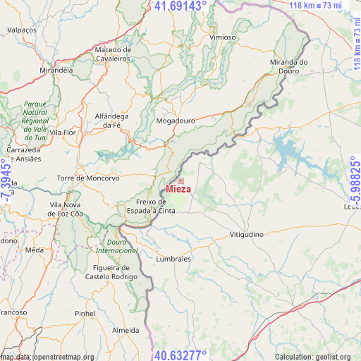
| Upper-left | 41.69143°, | -7.3945° |
| Center: | 41.16424°, | -6.69137° |
| Lower-right: | 40.63277°, | -5.98825° |
| Map W x H: | 117.7×117.7 km | = 73.1×73.1mi |
| max Lat: | 43.74134° ⇑47.7% North |
| Mieza: | 41.16424° |
| min Lat: | ⇓52.3% South 27.64134° |
| min Long | Mieza | max Long |
| -18.00367° | -6.69137° | 4.2899° |
| W 7.2%⇐ | ⇒92.8% E |
Elevation
Elevation of Mieza is 646 m = 2119 ft, and this is 48 m = 157 ft above average elevation for this country.
| Max E: |
1682 m = 5518 ft | 51.2% |
| Mieza | 646 m 2119 ft | |
| Avg. | 598 m = 1962 ft | |
Min E: |
0 m = 0 ft | 48.8% |
See also: Spain elevation on elevation.city.
Geographical zone
Mieza is located in North temperate zone (between Tropic of Cancer and the Arctic Circle). Distance of this Northern Tropic circle is 1971.1 km =1224.8 mi to South.| Distance of | km | miles | from Mieza |
|---|---|---|---|
| North Pole | 5430 | 3374 | to North |
| Arctic Circle | 2824.1 | 1754.8 | to North |
| Tropic Cancer | 1971.1 | 1224.8 | to South |
| Equator | 4577 | 2844 | to South |


Nearby cities:
15 places around Mieza: (largest is in red/bold)
• Aldeadávila de la Ribera
8.6 km =5.3 mi,  45°
45°
• Barruecopardo
10.5 km =6.5 mi,  167°
167°
• Bermellar
18.4 km =11.4 mi, 174°
• Cabeza del Caballo
11.9 km =7.4 mi,  108°
108°
• Cerezal de Peñahorcada
4.9 km =3 mi,  139°
139°
• Encinasola de los Comendadores
19.9 km =12.4 mi, 138°
• Hinojosa de Duero
21.6 km =13.4 mi,  203°
203°
• Masueco
9.6 km =6 mi,  62°
62°
• Saldeana
16.5 km =10.3 mi,  164°
164°
• Saucelle
14 km =8.7 mi, 201°
• Valderrodrigo
18.8 km =11.7 mi,  125°
125°
• Valsalabroso
16.9 km =10.5 mi, 111°
• Villarino de los Aires
22.1 km =13.7 mi, 57°
• Villasbuenas
13.8 km =8.6 mi, 144°
• Vilvestre
7.1 km =4.4 mi,  205°
205°
Sources, notices
• [Note1] Compared only with cities in Spain existing in our database
• [Src1] Map data: © OpenStreetMap contributors (CC-BY-SA)
• [Src2] Other city data from geonames.org with taken over terms of usage.
• [Src3] Geographical zone / Annual Mean Temperature by Robert A. Rohde @ Wikipedia
