Cerezal de Peñahorcada geodata
Cerezal de Peñahorcada (Castille and León) is a seat of a third-order administrative division; located in Spain in Europe/Madrid (GMT+2) time zone. With population of 127 people, there are 5616 cities with bigger population in this country. Compared to other cities in Spain, 51.7% of cities are located further ↓South; 92.4% of cities are located further →East and 54.4% of cities have lower elevation than Cerezal de Peñahorcada. Note1
Administrative division(s):
- Level 1: Castille and León
- Level 2: Provincia de Salamanca
- Level 3: Cerezal de Peñahorcada


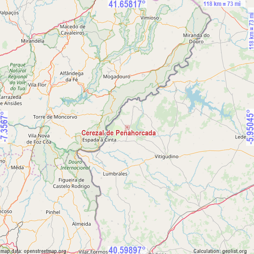
Cerezal de Peñahorcada GPS coordinates[2]
41° 7' 50.556" North, 6° 39' 12.852" West
| Map corner | latitude | longitude |
|---|---|---|
| Upper-left | 41.65817°, | -7.3567° |
| Center: | 41.13071°, | -6.65357° |
| Lower-right: | 40.59897°, | -5.95045° |
| Map W x H: | 117.8×117.8 km | = 73.2×73.2mi |
| max Lat: | 43.74134° ⇑48.3% North |
| Cerezal de Peñahorcada: | 41.13071° |
| min Lat: | ⇓51.7% South 27.64134° |
| min Long | Cerezal de Peñ | max Long |
| -18.00367° | -6.65357° | 4.2899° |
| W 7.6%⇐ | ⇒92.4% E |
Elevation
Elevation of Cerezal de Peñahorcada is 704 m = 2310 ft, and this is 106 m = 348 ft above average elevation for this country.
| Max E: |
1682 m = 5518 ft | 45.6% |
| Cerezal de Peñahorcada | 704 m 2310 ft | |
| Avg. | 598 m = 1962 ft | |
Min E: |
0 m = 0 ft | 54.4% |
See also: Spain elevation on elevation.city.
Geographical zone
Cerezal de Peñahorcada is located in North temperate zone (between Tropic of Cancer and the Arctic Circle). Distance of this Northern Tropic circle is 1967.4 km =1222.5 mi to South.| Distance of | km | miles | from Cerezal de Peñahorcada |
|---|---|---|---|
| North Pole | 5433.8 | 3376.4 | to North |
| Arctic Circle | 2827.9 | 1757.2 | to North |
| Tropic Cancer | 1967.4 | 1222.5 | to South |
| Equator | 4573.3 | 2841.7 | to South |


Nearby cities:
15 places around Cerezal de Peñahorcada: (largest is in red/bold)
• Aldeadávila de la Ribera
10.1 km =6.3 mi,  17°
17°
• Barruecopardo
6.6 km =4.1 mi,  187°
187°
• Bermellar
14.7 km =9.1 mi, 185°
• Cabeza del Caballo
8.1 km =5 mi,  90°
90°
• Cerralbo
18.4 km =11.4 mi,  162°
162°
• Encinasola de los Comendadores
15 km =9.3 mi,  137°
137°
• Guadramiro
18.4 km =11.4 mi,  133°
133°
• Masueco
9.7 km =6 mi,  33°
33°
• Mieza
4.9 km =3 mi,  319°
319°
• Saldeana
12.3 km =7.6 mi,  174°
174°
• Saucelle
12.5 km =7.8 mi,  222°
222°
• Valderrodrigo
14.1 km =8.8 mi,  120°
120°
• Valsalabroso
12.9 km =8 mi,  100°
100°
• Villasbuenas
8.9 km =5.5 mi,  147°
147°
• Vilvestre
6.7 km =4.2 mi,  246°
246°
Sources, notices
• [Note1] Compared only with cities in Spain existing in our database
• [Src1] Map data: © OpenStreetMap contributors (CC-BY-SA)
• [Src2] Other city data from geonames.org with taken over terms of usage.
• [Src3] Geographical zone / Annual Mean Temperature by Robert A. Rohde @ Wikipedia
