Mengamuñoz geodata
Mengamuñoz (Castille and León) is a seat of a third-order administrative division; located in Spain in Europe/Madrid (GMT+2) time zone. With population of 67 people, there are 6274 cities with bigger population in this country. Compared to other cities in Spain, 61.9% of cities are located further ↑North; 72.5% of cities are located further →East and 98.7% of cities have lower elevation than Mengamuñoz. Note1
Administrative division(s):
- Level 1: Castille and León
- Level 2: Provincia de Ávila
- Level 3: Mengamuñoz


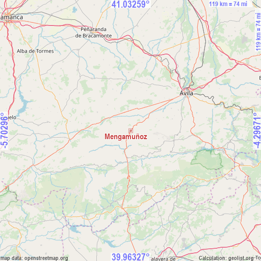
Mengamuñoz GPS coordinates[2]
40° 30' 0.216" North, 4° 59' 59.388" West
| Map corner | latitude | longitude |
|---|---|---|
| Upper-left | 41.03259°, | -5.70296° |
| Center: | 40.50006°, | -4.99983° |
| Lower-right: | 39.96327°, | -4.29671° |
| Map W x H: | 118.9×118.9 km | = 73.9×73.9mi |
| max Lat: | 43.74134° ⇑61.9% North |
| Mengamuñoz: | 40.50006° |
| min Lat: | ⇓38.1% South 27.64134° |
| min Long | Mengamuñoz | max Long |
| -18.00367° | -4.99983° | 4.2899° |
| W 27.5%⇐ | ⇒72.5% E |
Elevation
Elevation of Mengamuñoz is 1318 m = 4324 ft, and this is 720 m = 2362 ft above average elevation for this country.
| Max E: |
1682 m = 5518 ft | 1.3% |
| Mengamuñoz | 1318 m 4324 ft | |
| Avg. | 598 m = 1962 ft | |
Min E: |
0 m = 0 ft | 98.7% |
See also: Spain elevation on elevation.city.
Geographical zone
Mengamuñoz is located in North temperate zone (between Tropic of Cancer and the Arctic Circle). Distance of this Northern Tropic circle is 1897.3 km =1178.9 mi to South.| Distance of | km | miles | from Mengamuñoz |
|---|---|---|---|
| North Pole | 5503.9 | 3420 | to North |
| Arctic Circle | 2898 | 1800.7 | to North |
| Tropic Cancer | 1897.3 | 1178.9 | to South |
| Equator | 4503.2 | 2798.2 | to South |


Nearby cities:
15 places around Mengamuñoz: (largest is in red/bold)
• Amavida
9.9 km =6.2 mi,  325°
325°
• Cepeda la Mora
6.2 km =3.9 mi,  221°
221°
• Garganta del Villar
10.5 km =6.5 mi,  237°
237°
• Hoyocasero
11.4 km =7.1 mi,  169°
169°
• Muñana
10.1 km =6.3 mi,  352°
352°
• Muñotello
5.9 km =3.7 mi,  322°
322°
• Narros del Puerto
4.6 km =2.9 mi,  7°
7°
• Navadijos
10.9 km =6.8 mi, 220°
• Navalacruz
8.9 km =5.5 mi,  139°
139°
• Navalosa
12.4 km =7.7 mi,  151°
151°
• Navaquesera
11.2 km =7 mi, 137°
• Poveda
10.1 km =6.3 mi, 318°
• Pradosegar
8.1 km =5 mi,  313°
313°
• Solosancho
10 km =6.2 mi,  53°
53°
• Villatoro
11.4 km =7.1 mi,  303°
303°
Sources, notices
• [Note1] Compared only with cities in Spain existing in our database
• [Src1] Map data: © OpenStreetMap contributors (CC-BY-SA)
• [Src2] Other city data from geonames.org with taken over terms of usage.
• [Src3] Geographical zone / Annual Mean Temperature by Robert A. Rohde @ Wikipedia
