Navalacruz geodata
Navalacruz (Castille and León) is a seat of a third-order administrative division; located in Spain in Europe/Madrid (GMT+2) time zone. With population of 271 people, there are 4626 cities with bigger population in this country. Compared to other cities in Spain, 63.1% of cities are located further ↑North; 71.6% of cities are located further →East and 97.7% of cities have lower elevation than Navalacruz. Note1
Administrative division(s):
- Level 1: Castille and León
- Level 2: Provincia de Ávila
- Level 3: Navalacruz


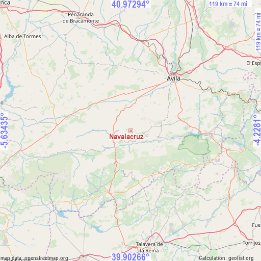
Navalacruz GPS coordinates[2]
40° 26' 23.748" North, 4° 55' 52.392" West
| Map corner | latitude | longitude |
|---|---|---|
| Upper-left | 40.97294°, | -5.63435° |
| Center: | 40.43993°, | -4.93122° |
| Lower-right: | 39.90266°, | -4.2281° |
| Map W x H: | 119×119 km | = 73.9×73.9mi |
| max Lat: | 43.74134° ⇑63.1% North |
| Navalacruz: | 40.43993° |
| min Lat: | ⇓36.9% South 27.64134° |
| min Long | Navalacruz | max Long |
| -18.00367° | -4.93122° | 4.2899° |
| W 28.4%⇐ | ⇒71.6% E |
Elevation
Elevation of Navalacruz is 1236 m = 4055 ft, and this is 638 m = 2093 ft above average elevation for this country.
| Max E: |
1682 m = 5518 ft | 2.3% |
| Navalacruz | 1236 m 4055 ft | |
| Avg. | 598 m = 1962 ft | |
Min E: |
0 m = 0 ft | 97.7% |
See also: Spain elevation on elevation.city.
Geographical zone
Navalacruz is located in North temperate zone (between Tropic of Cancer and the Arctic Circle). Distance of this Northern Tropic circle is 1890.6 km =1174.8 mi to South.| Distance of | km | miles | from Navalacruz |
|---|---|---|---|
| North Pole | 5510.6 | 3424.1 | to North |
| Arctic Circle | 2904.7 | 1804.9 | to North |
| Tropic Cancer | 1890.6 | 1174.8 | to South |
| Equator | 4496.5 | 2794 | to South |


Nearby cities:
15 places around Navalacruz: (largest is in red/bold)
• Burgohondo
12.7 km =7.9 mi,  103°
103°
• Cepeda la Mora
10.1 km =6.3 mi,  281°
281°
• Hoyocasero
5.9 km =3.7 mi,  218°
218°
• Hoyos de Miguel Muñoz
12.7 km =7.9 mi,  245°
245°
• Mengamuñoz
8.9 km =5.5 mi,  319°
319°
• Narros del Puerto
12.4 km =7.7 mi,  335°
335°
• Navadijos
12.9 km =8 mi,  262°
262°
• Navalosa
4.2 km =2.6 mi,  178°
178°
• Navaquesera
2.3 km =1.4 mi,  133°
133°
• Navarredondilla
9.4 km =5.8 mi,  80°
80°
• Navarrevisca
9 km =5.6 mi,  159°
159°
• Navatalgordo
5.8 km =3.6 mi,  118°
118°
• San Juan del Molinillo
9.9 km =6.2 mi, 77°
• Serranillos
11.6 km =7.2 mi,  171°
171°
• Solosancho
12.8 km =8 mi,  10°
10°
Sources, notices
• [Note1] Compared only with cities in Spain existing in our database
• [Src1] Map data: © OpenStreetMap contributors (CC-BY-SA)
• [Src2] Other city data from geonames.org with taken over terms of usage.
• [Src3] Geographical zone / Annual Mean Temperature by Robert A. Rohde @ Wikipedia
