Mazarete geodata
Mazarete (Castille-La Mancha) is a seat of a third-order administrative division; located in Spain in Europe/Madrid (GMT+2) time zone. With population of 66 people, there are 6282 cities with bigger population in this country. Compared to other cities in Spain, 51.5% of cities are located further ↑North; 65.3% of cities are located further ←West and 97.1% of cities have lower elevation than Mazarete. Note1
Administrative division(s):
- Level 1: Castille-La Mancha
- Level 2: Provincia de Guadalajara
- Level 3: Mazarete


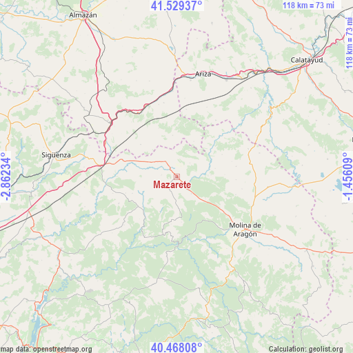
Mazarete GPS coordinates[2]
41° 0' 3.096" North, 2° 9' 33.156" West
| Map corner | latitude | longitude |
|---|---|---|
| Upper-left | 41.52937°, | -2.86234° |
| Center: | 41.00086°, | -2.15921° |
| Lower-right: | 40.46808°, | -1.45609° |
| Map W x H: | 118×118 km | = 73.3×73.3mi |
| max Lat: | 43.74134° ⇑51.5% North |
| Mazarete: | 41.00086° |
| min Lat: | ⇓48.5% South 27.64134° |
| min Long | Mazarete | max Long |
| -18.00367° | -2.15921° | 4.2899° |
| W 65.3%⇐ | ⇒34.7% E |
Elevation
Elevation of Mazarete is 1207 m = 3960 ft, and this is 609 m = 1998 ft above average elevation for this country.
| Max E: |
1682 m = 5518 ft | 2.9% |
| Mazarete | 1207 m 3960 ft | |
| Avg. | 598 m = 1962 ft | |
Min E: |
0 m = 0 ft | 97.1% |
See also: Spain elevation on elevation.city.
Geographical zone
Mazarete is located in North temperate zone (between Tropic of Cancer and the Arctic Circle). Distance of this Northern Tropic circle is 1952.9 km =1213.5 mi to South.| Distance of | km | miles | from Mazarete |
|---|---|---|---|
| North Pole | 5448.2 | 3385.4 | to North |
| Arctic Circle | 2842.3 | 1766.1 | to North |
| Tropic Cancer | 1952.9 | 1213.5 | to South |
| Equator | 4558.9 | 2832.8 | to South |


Nearby cities:
15 places around Mazarete: (largest is in red/bold)
• Ablanque
12.7 km =7.9 mi,  205°
205°
• Anguita
17.8 km =11.1 mi,  279°
279°
• Anquela del Ducado
4.1 km =2.5 mi,  144°
144°
• Cobeta
15.1 km =9.4 mi,  174°
174°
• Establés
11.3 km =7 mi,  86°
86°
• Iniéstola
17.8 km =11.1 mi,  267°
267°
• Luzón
10.3 km =6.4 mi,  286°
286°
• Maranchón
6.4 km =4 mi,  323°
323°
• Mochales
16.1 km =10 mi,  48°
48°
• Olmeda de Cobeta
15.8 km =9.8 mi,  187°
187°
• Riba de Saelices
15.3 km =9.5 mi,  229°
229°
• Saelices de la Sal
17.3 km =10.7 mi, 232°
• Selas
7.3 km =4.5 mi, 138°
• Tartanedo
19.7 km =12.2 mi, 92°
• Torremocha del Pinar
15.7 km =9.8 mi, 142°
Sources, notices
• [Note1] Compared only with cities in Spain existing in our database
• [Src1] Map data: © OpenStreetMap contributors (CC-BY-SA)
• [Src2] Other city data from geonames.org with taken over terms of usage.
• [Src3] Geographical zone / Annual Mean Temperature by Robert A. Rohde @ Wikipedia
