Ablanque geodata
Ablanque (Castille-La Mancha) is a seat of a third-order administrative division; located in Spain in Europe/Madrid (GMT+2) time zone. With population of 138 people, there are 5518 cities with bigger population in this country. Compared to other cities in Spain, 53.9% of cities are located further ↑North; 64.4% of cities are located further ←West and 90.1% of cities have lower elevation than Ablanque. Note1
Administrative division(s):
- Level 1: Castille-La Mancha
- Level 2: Provincia de Guadalajara
- Level 3: Ablanque


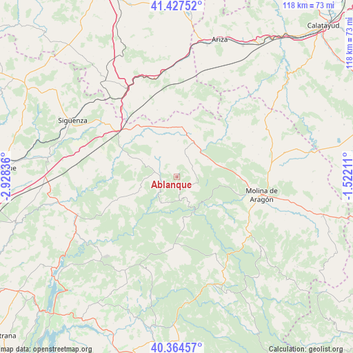
Ablanque GPS coordinates[2]
40° 53' 53.448" North, 2° 13' 30.828" West
| Map corner | latitude | longitude |
|---|---|---|
| Upper-left | 41.42752°, | -2.92836° |
| Center: | 40.89818°, | -2.22523° |
| Lower-right: | 40.36457°, | -1.52211° |
| Map W x H: | 118.2×118.2 km | = 73.4×73.4mi |
| max Lat: | 43.74134° ⇑53.9% North |
| Ablanque: | 40.89818° |
| min Lat: | ⇓46.1% South 27.64134° |
| min Long | Ablanque | max Long |
| -18.00367° | -2.22523° | 4.2899° |
| W 64.4%⇐ | ⇒35.6% E |
Elevation
Elevation of Ablanque is 1033 m = 3389 ft, and this is 435 m = 1427 ft above average elevation for this country.
| Max E: |
1682 m = 5518 ft | 9.9% |
| Ablanque | 1033 m 3389 ft | |
| Avg. | 598 m = 1962 ft | |
Min E: |
0 m = 0 ft | 90.1% |
See also: Spain elevation on elevation.city.
Geographical zone
Ablanque is located in North temperate zone (between Tropic of Cancer and the Arctic Circle). Distance of this Northern Tropic circle is 1941.5 km =1206.4 mi to South.| Distance of | km | miles | from Ablanque |
|---|---|---|---|
| North Pole | 5459.6 | 3392.4 | to North |
| Arctic Circle | 2853.7 | 1773.2 | to North |
| Tropic Cancer | 1941.5 | 1206.4 | to South |
| Equator | 4547.5 | 2825.7 | to South |


Nearby cities:
15 places around Ablanque: (largest is in red/bold)
• Anquela del Ducado
11.3 km =7 mi,  44°
44°
• Cobeta
7.9 km =4.9 mi,  117°
117°
• Esplegares
13.1 km =8.1 mi,  249°
249°
• Huertahernando
9.8 km =6.1 mi,  212°
212°
• Iniéstola
16.2 km =10.1 mi,  311°
311°
• Luzón
15 km =9.3 mi,  343°
343°
• Maranchón
16.7 km =10.4 mi,  5°
5°
• Mazarete
12.7 km =7.9 mi,  25°
25°
• Olmeda de Cobeta
5.6 km =3.5 mi,  140°
140°
• Riba de Saelices
6.2 km =3.9 mi,  283°
283°
• Saelices de la Sal
8.3 km =5.2 mi, 276°
• Selas
11.9 km =7.4 mi,  60°
60°
• Sotodosos
14.3 km =8.9 mi, 280°
• Torremocha del Pinar
15.2 km =9.4 mi,  93°
93°
• Zaorejas
15.3 km =9.5 mi,  172°
172°
Sources, notices
• [Note1] Compared only with cities in Spain existing in our database
• [Src1] Map data: © OpenStreetMap contributors (CC-BY-SA)
• [Src2] Other city data from geonames.org with taken over terms of usage.
• [Src3] Geographical zone / Annual Mean Temperature by Robert A. Rohde @ Wikipedia
