Llançà geodata
Llançà (Catalonia) is a populated place; located in Spain in Europe/Madrid (GMT+2) time zone. With population of 5,000 people, there are 1308 cities with bigger population in this country. Compared to other cities in Spain, 83.7% of cities are located further ↓South; 99.6% of cities are located further ←West and 97.6% of cities have higher elevation than Llançà. Note1


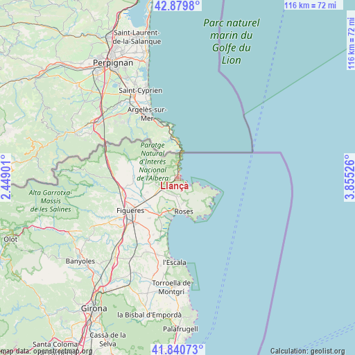
Llançà GPS coordinates[2]
42° 21' 44.676" North, 3° 9' 7.668" East
| Map corner | latitude | longitude |
|---|---|---|
| Upper-left | 42.8798°, | 2.44901° |
| Center: | 42.36241°, | 3.15213° |
| Lower-right: | 41.84073°, | 3.85526° |
| Map W x H: | 115.5×115.5 km | = 71.8×71.8mi |
| max Lat: | 43.74134° ⇑16.3% North |
| Llançà: | 42.36241° |
| min Lat: | ⇓83.7% South 27.64134° |
| min Long | Llançà | max Long |
| -18.00367° | 3.15213° | 4.2899° |
| W 99.6%⇐ | ⇒0.40000000000001% E |
Elevation
Elevation of Llançà is 13 m = 43 ft, and this is 585 m = 1919 ft below average elevation for this country.
| Max E: |
1682 m = 5518 ft | 97.6% |
| Avg. | 598 m = 1962 ft | |
| Llançà | 13 m = 43 ft | |
Min E: |
0 m = 0 ft | 2.4% |
See also: Spain elevation on elevation.city.
Geographical zone
Llançà is located in North temperate zone (between Tropic of Cancer and the Arctic Circle). Distance of this Northern Tropic circle is 2104.3 km =1307.6 mi to South.| Distance of | km | miles | from Llançà |
|---|---|---|---|
| North Pole | 5296.8 | 3291.3 | to North |
| Arctic Circle | 2690.9 | 1672 | to North |
| Tropic Cancer | 2104.3 | 1307.6 | to South |
| Equator | 4710.3 | 2926.8 | to South |


Nearby cities:
15 places around Llançà: (largest is in red/bold)
• Cadaqués
13.1 km =8.1 mi,  128°
128°
• Castelló d'Empúries
13.4 km =8.3 mi,  208°
208°
• Colera
4.6 km =2.9 mi,  359°
359°
• Empuriabrava
13.1 km =8.1 mi,  191°
191°
• Espolla
12.8 km =8 mi,  284°
284°
• Garriguella
7.4 km =4.6 mi,  253°
253°
• Mollet de Peralada
12.5 km =7.8 mi,  268°
268°
• Pau
5.9 km =3.7 mi, 209°
• Peralada
13.2 km =8.2 mi,  242°
242°
• Portbou
7.1 km =4.4 mi,  3°
3°
• Rabós
10.3 km =6.4 mi, 280°
• Roses
11.3 km =7 mi,  169°
169°
• Vilajuïga
6.4 km =4 mi,  229°
229°
• Vilamaniscle
7.1 km =4.4 mi, 281°
• el Port de la Selva
5.2 km =3.2 mi,  123°
123°
Sources, notices
• [Note1] Compared only with cities in Spain existing in our database
• [Src1] Map data: © OpenStreetMap contributors (CC-BY-SA)
• [Src2] Other city data from geonames.org with taken over terms of usage.
• [Src3] Geographical zone / Annual Mean Temperature by Robert A. Rohde @ Wikipedia
