Lladó geodata
Lladó (Catalonia) is a seat of a third-order administrative division; located in Spain in Europe/Madrid (GMT+2) time zone. With population of 580 people, there are 3658 cities with bigger population in this country. Compared to other cities in Spain, 80.5% of cities are located further ↓South; 97.7% of cities are located further ←West and 81.2% of cities have higher elevation than Lladó. Note1


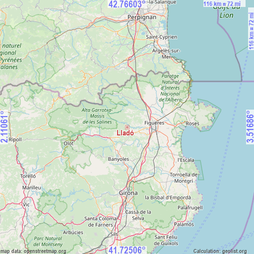
Lladó GPS coordinates[2]
42° 14' 51.684" North, 2° 48' 49.428" East
| Map corner | latitude | longitude |
|---|---|---|
| Upper-left | 42.76603°, | 2.11061° |
| Center: | 42.24769°, | 2.81373° |
| Lower-right: | 41.72506°, | 3.51686° |
| Map W x H: | 115.7×115.7 km | = 71.9×71.9mi |
| max Lat: | 43.74134° ⇑19.5% North |
| Lladó: | 42.24769° |
| min Lat: | ⇓80.5% South 27.64134° |
| min Long | Lladó | max Long |
| -18.00367° | 2.81373° | 4.2899° |
| W 97.7%⇐ | ⇒2.3% E |
Elevation
Elevation of Lladó is 199 m = 653 ft, and this is 399 m = 1309 ft below average elevation for this country.
| Max E: |
1682 m = 5518 ft | 81.2% |
| Avg. | 598 m = 1962 ft | |
| Lladó | 199 m = 653 ft | |
Min E: |
0 m = 0 ft | 18.8% |
See also: Spain elevation on elevation.city.
Geographical zone
Lladó is located in North temperate zone (between Tropic of Cancer and the Arctic Circle). Distance of this Northern Tropic circle is 2091.6 km =1299.7 mi to South.| Distance of | km | miles | from Lladó |
|---|---|---|---|
| North Pole | 5309.6 | 3299.2 | to North |
| Arctic Circle | 2703.7 | 1680 | to North |
| Tropic Cancer | 2091.6 | 1299.7 | to South |
| Equator | 4697.5 | 2918.9 | to South |


Nearby cities:
15 places around Lladó: (largest is in red/bold)
• Avinyonet de Puigventós
8.3 km =5.2 mi,  88°
88°
• Beuda
8.7 km =5.4 mi,  262°
262°
• Borrassà
9.6 km =6 mi,  106°
106°
• Cabanelles
2 km =1.2 mi,  164°
164°
• Cistella
3.6 km =2.2 mi,  50°
50°
• Crespià
7.2 km =4.5 mi,  188°
188°
• Esponellà
9.1 km =5.7 mi, 187°
• Llers
9.7 km =6 mi,  56°
56°
• Navata
4.7 km =2.9 mi,  124°
124°
• Ordis
8.3 km =5.2 mi, 113°
• Pontós
10.9 km =6.8 mi,  128°
128°
• Sant Llorenç de la Muga
8.3 km =5.2 mi,  345°
345°
• Terrades
7.3 km =4.5 mi,  16°
16°
• Vilafant
10.2 km =6.3 mi, 90°
• Vilanant
6.3 km =3.9 mi,  82°
82°
Sources, notices
• [Note1] Compared only with cities in Spain existing in our database
• [Src1] Map data: © OpenStreetMap contributors (CC-BY-SA)
• [Src2] Other city data from geonames.org with taken over terms of usage.
• [Src3] Geographical zone / Annual Mean Temperature by Robert A. Rohde @ Wikipedia
