Lardero geodata
Lardero (La Rioja) is a seat of a third-order administrative division; located in Spain in Europe/Madrid (GMT+2) time zone. With population of 6,214 people, there are 1113 cities with bigger population in this country. Compared to other cities in Spain, 85.6% of cities are located further ↓South; 61.4% of cities are located further ←West and 66.7% of cities have higher elevation than Lardero. Note1


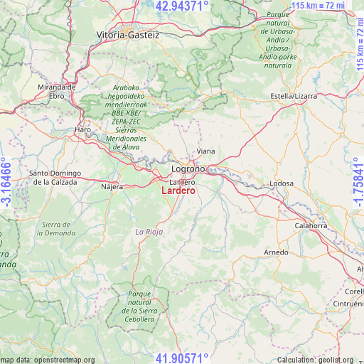
Lardero GPS coordinates[2]
42° 25' 36.696" North, 2° 27' 41.508" West
| Map corner | latitude | longitude |
|---|---|---|
| Upper-left | 42.94371°, | -3.16466° |
| Center: | 42.42686°, | -2.46153° |
| Lower-right: | 41.90571°, | -1.75841° |
| Map W x H: | 115.4×115.4 km | = 71.7×71.7mi |
| max Lat: | 43.74134° ⇑14.4% North |
| Lardero: | 42.42686° |
| min Lat: | ⇓85.6% South 27.64134° |
| min Long | Lardero | max Long |
| -18.00367° | -2.46153° | 4.2899° |
| W 61.4%⇐ | ⇒38.6% E |
Elevation
Elevation of Lardero is 438 m = 1437 ft, and this is 160 m = 525 ft below average elevation for this country.
| Max E: |
1682 m = 5518 ft | 66.7% |
| Avg. | 598 m = 1962 ft | |
| Lardero | 438 m = 1437 ft | |
Min E: |
0 m = 0 ft | 33.3% |
See also: Spain elevation on elevation.city.
Geographical zone
Lardero is located in North temperate zone (between Tropic of Cancer and the Arctic Circle). Distance of this Northern Tropic circle is 2111.5 km =1312 mi to South.| Distance of | km | miles | from Lardero |
|---|---|---|---|
| North Pole | 5289.6 | 3286.8 | to North |
| Arctic Circle | 2683.7 | 1667.6 | to North |
| Tropic Cancer | 2111.5 | 1312 | to South |
| Equator | 4717.4 | 2931.3 | to South |


Nearby cities:
15 places around Lardero: (largest is in red/bold)
• Albelda de Iregua
7.7 km =4.8 mi,  186°
186°
• Alberite
2.9 km =1.8 mi,  139°
139°
• Clavijo
9.1 km =5.7 mi,  161°
161°
• Entrena
7.1 km =4.4 mi,  232°
232°
• Fuenmayor
9.4 km =5.8 mi,  298°
298°
• Hornos de Moncalvillo
10.9 km =6.8 mi,  249°
249°
• Logroño
4.5 km =2.8 mi,  12°
12°
• Medrano
9 km =5.6 mi,  237°
237°
• Nalda
10.5 km =6.5 mi, 191°
• Navarrete
8.5 km =5.3 mi,  272°
272°
• Oion / Oyón
9 km =5.6 mi, 13°
• Ribafrecha
9.9 km =6.2 mi, 143°
• Sojuela
9.3 km =5.8 mi, 227°
• Sorzano
10.8 km =6.7 mi,  210°
210°
• Villamediana de Iregua
3.5 km =2.2 mi,  90°
90°
Sources, notices
• [Note1] Compared only with cities in Spain existing in our database
• [Src1] Map data: © OpenStreetMap contributors (CC-BY-SA)
• [Src2] Other city data from geonames.org with taken over terms of usage.
• [Src3] Geographical zone / Annual Mean Temperature by Robert A. Rohde @ Wikipedia
