La Puebla de Valverde geodata
La Puebla de Valverde (Aragon) is a populated place; located in Spain in Europe/Madrid (GMT+2) time zone. With population of 513 people, there are 3843 cities with bigger population in this country. Compared to other cities in Spain, 66.8% of cities are located further ↑North; 77.8% of cities are located further ←West and 93.6% of cities have lower elevation than La Puebla de Valverde. Note1
Administrative division(s):
- Level 1: Aragon
- Level 2: Provincia de Teruel
- Level 3: Puebla de Valverde, La


La Puebla de Valverde GPS coordinates[2]
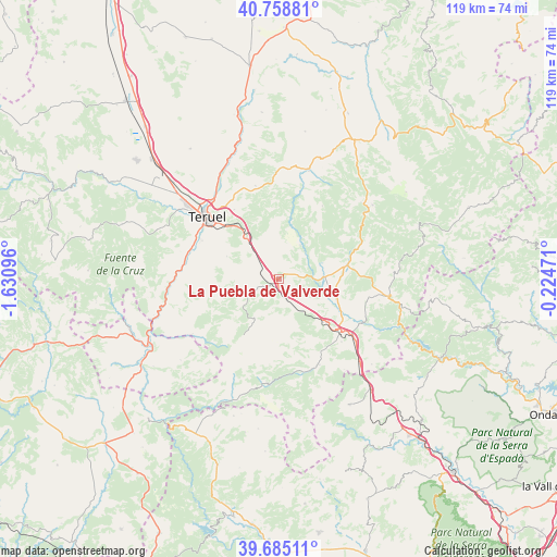
40° 13' 26.724" North, 0° 55' 40.188" West
| Map corner | latitude | longitude |
|---|---|---|
| Upper-left | 40.75881°, | -1.63096° |
| Center: | 40.22409°, | -0.92783° |
| Lower-right: | 39.68511°, | -0.22471° |
| Map W x H: | 119.4×119.4 km | = 74.2×74.2mi |
| max Lat: | 43.74134° ⇑66.8% North |
| La Puebla de Valverde: | 40.22409° |
| min Lat: | ⇓33.2% South 27.64134° |
| min Long | La Puebla de Va | max Long |
| -18.00367° | -0.92783° | 4.2899° |
| W 77.8%⇐ | ⇒22.2% E |
Elevation
Elevation of La Puebla de Valverde is 1108 m = 3635 ft, and this is 510 m = 1673 ft above average elevation for this country.
| Max E: |
1682 m = 5518 ft | 6.4% |
| La Puebla de Valverde | 1108 m 3635 ft | |
| Avg. | 598 m = 1962 ft | |
Min E: |
0 m = 0 ft | 93.6% |
See also: Spain elevation on elevation.city.
Geographical zone
La Puebla de Valverde is located in North temperate zone (between Tropic of Cancer and the Arctic Circle). Distance of this Northern Tropic circle is 1866.6 km =1159.9 mi to South.| Distance of | km | miles | from La Puebla de Valverde |
|---|---|---|---|
| North Pole | 5534.6 | 3439 | to North |
| Arctic Circle | 2928.7 | 1819.8 | to North |
| Tropic Cancer | 1866.6 | 1159.9 | to South |
| Equator | 4472.5 | 2779.1 | to South |


Nearby cities:
15 places around La Puebla de Valverde: (largest is in red/bold)
• Albentosa
19.2 km =11.9 mi,  134°
134°
• Cabra de Mora
14.6 km =9.1 mi,  44°
44°
• Camarena de la Sierra
12.2 km =7.6 mi,  227°
227°
• Cascante del Río
16.1 km =10 mi,  259°
259°
• Corbalán
20.5 km =12.7 mi,  346°
346°
• Cubla
12.9 km =8 mi, 262°
• El Castellar
18.3 km =11.4 mi,  30°
30°
• Formiche Alto
11.5 km =7.1 mi,  15°
15°
• Manzanera
21 km =13 mi,  157°
157°
• Mora de Rubielos
15.2 km =9.4 mi,  78°
78°
• Sarrión
13.2 km =8.2 mi, 133°
• Teruel
20.3 km =12.6 mi,  311°
311°
• Valacloche
14.4 km =8.9 mi, 255°
• Valbona
9.9 km =6.2 mi,  87°
87°
• Villastar
20 km =12.4 mi,  288°
288°
Sources, notices
• [Note1] Compared only with cities in Spain existing in our database
• [Src1] Map data: © OpenStreetMap contributors (CC-BY-SA)
• [Src2] Other city data from geonames.org with taken over terms of usage.
• [Src3] Geographical zone / Annual Mean Temperature by Robert A. Rohde @ Wikipedia
