La Ercina geodata
La Ercina (Castille and León) is a populated place; located in Spain in Europe/Madrid (GMT+2) time zone. With population of 678 people, there are 3440 cities with bigger population in this country. Compared to other cities in Spain, 92.8% of cities are located further ↓South; 75.3% of cities are located further →East and 93.7% of cities have lower elevation than La Ercina. Note1
Administrative division(s):
- Level 1: Castille and León
- Level 2: Provincia de León
- Level 3: Ercina, La


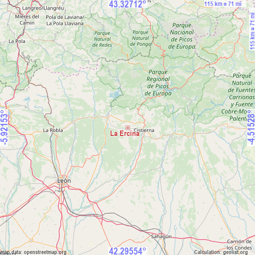
La Ercina GPS coordinates[2]
42° 48' 48.528" North, 5° 13' 6.24" West
| Map corner | latitude | longitude |
|---|---|---|
| Upper-left | 43.32712°, | -5.92153° |
| Center: | 42.81348°, | -5.2184° |
| Lower-right: | 42.29554°, | -4.51528° |
| Map W x H: | 114.7×114.7 km | = 71.3×71.3mi |
| max Lat: | 43.74134° ⇑7.2% North |
| La Ercina: | 42.81348° |
| min Lat: | ⇓92.8% South 27.64134° |
| min Long | La Ercina | max Long |
| -18.00367° | -5.2184° | 4.2899° |
| W 24.7%⇐ | ⇒75.3% E |
Elevation
Elevation of La Ercina is 1109 m = 3638 ft, and this is 511 m = 1677 ft above average elevation for this country.
| Max E: |
1682 m = 5518 ft | 6.3% |
| La Ercina | 1109 m 3638 ft | |
| Avg. | 598 m = 1962 ft | |
Min E: |
0 m = 0 ft | 93.7% |
See also: Spain elevation on elevation.city.
Geographical zone
La Ercina is located in North temperate zone (between Tropic of Cancer and the Arctic Circle). Distance of this Northern Tropic circle is 2154.5 km =1338.7 mi to South.| Distance of | km | miles | from La Ercina |
|---|---|---|---|
| North Pole | 5246.6 | 3260.1 | to North |
| Arctic Circle | 2640.8 | 1640.9 | to North |
| Tropic Cancer | 2154.5 | 1338.7 | to South |
| Equator | 4760.4 | 2958 | to South |


Nearby cities:
15 places around La Ercina: (largest is in red/bold)
• Boñar
10.4 km =6.5 mi,  304°
304°
• Cebanico
18.5 km =11.5 mi,  121°
121°
• Cistierna
7.6 km =4.7 mi,  98°
98°
• Crémenes
11.7 km =7.3 mi,  31°
31°
• Cubillas de Rueda
17.8 km =11.1 mi,  168°
168°
• Gradefes
21.1 km =13.1 mi,  181°
181°
• Prado de la Guzpeña
16.1 km =10 mi, 102°
• Prioro
22.7 km =14.1 mi,  66°
66°
• Puebla de Lillo
22 km =13.7 mi,  348°
348°
• Reyero
15.1 km =9.4 mi,  6°
6°
• Sabero
6.2 km =3.9 mi, 66°
• Santa Colomba de Curueño
17.3 km =10.7 mi,  246°
246°
• Valdepiélago
15.9 km =9.9 mi,  292°
292°
• Valderrueda
22.1 km =13.7 mi,  89°
89°
• Vegaquemada
9.3 km =5.8 mi,  273°
273°
Sources, notices
• [Note1] Compared only with cities in Spain existing in our database
• [Src1] Map data: © OpenStreetMap contributors (CC-BY-SA)
• [Src2] Other city data from geonames.org with taken over terms of usage.
• [Src3] Geographical zone / Annual Mean Temperature by Robert A. Rohde @ Wikipedia
